Welcome to Visit Tandridge Places
The Walkfo guide to things to do & explore in Tandridge
 Visit Tandridge places using Walkfo for free guided tours of the best Tandridge places to visit. A unique way to experience Tandridge’s places, Walkfo allows you to explore Tandridge as you would a museum or art gallery with audio guides.
Visiting Tandridge Walkfo Preview
The village is acknowledged locally for its friendly atmosphere and sense of community. It has one of the oldest yew trees in the country, a Grade I-listed church and the tomb of the church’s main benefactor Sir George Gilbert Scott’s wife, Lady Scott. When you visit Tandridge, Walkfo brings Tandridge places to life as you travel by foot, bike, bus or car with a mobile phone & headphones.
Tandridge Places Overview: History, Culture & Facts about Tandridge
Visit Tandridge – Walkfo’s stats for the places to visit
With 14 audio plaques & Tandridge places for you to explore in the Tandridge area, Walkfo is the world’s largest heritage & history digital plaque provider. The AI continually learns & refines facts about the best Tandridge places to visit from travel & tourism authorities (like Wikipedia), converting history into an interactive audio experience.
Tandridge history
Middle Ages
Tandridge appears in Domesday Book of 1086 as Tenrige. It was held by the wife of Salie from Richard Fitz Gilbert. Its domesday assets were: 2 hides; 1 mill worth 4s 2d, 14 ploughs, 5 acres of meadow, woodland and herbage worth 51 hogs.
Manorial descent (reversion) and rebuilding
Gilbert de Clare died in 1314 which triggered the division of his lands between his sisters and co-heirs. Eleanor wife of Hugh Despenser the Younger succeeded to the knights’ fees flowing yearly from the manor. The Despensers and their descendants, the Beauchamps, settled on the childhood prize of wealth in the country.
Industries post-Dissolution
‘Woodcock’s Hammer’ denoted what was the far south of the parish, near Hedgecourt (in Felbridge) in 1761. In 1912 the parish was “chiefly agricultural, but there [we]re brick and tile works in it”
Tandridge landmarks
Yew tree
In the churchyard of Tandridge church is an ancient yew tree, of a size to indicate it is over 1,500 years old. It was measured as 32.5 feet (9.9 m) in 1912, quite hollow but “full of life with four great limbs”
Church
St. Peter’s Church occupies an elevated and prominent position in the parish. The nave is much of the late 11th century, with a wall and carved priest’s door in the north of the chancel of the same date. In the churchyard are tombs/headstones/vaults to the Lord Chancellor (the 1st Earl of Cottenham) and the rest of his Pepys family.
Tandridge geography / climate
Beechwood Hill, at 160 metres above sea level, is the 23rd highest hill in Sussex. The ridge is part of the Greensand Ridge which is patchy in Tandridge, the middle of its extent from the West Sussex border to South-East Kent.
Localities
Only one named hamlet is within the parish bounds, Crowhurst Lane End. Lane End is midway between the cluster of homes of villagers who are not smallholders or large-scale farmers.
Why visit Tandridge with Walkfo Travel Guide App?
 You can visit Tandridge places with Walkfo Tandridge to hear history at Tandridge’s places whilst walking around using the free digital tour app. Walkfo Tandridge has 14 places to visit in our interactive Tandridge map, with amazing history, culture & travel facts you can explore the same way you would at a museum or art gallery with information audio headset. With Walkfo, you can travel by foot, bike or bus throughout Tandridge, being in the moment, without digital distraction or limits to a specific walking route. Our historic audio walks, National Trust interactive audio experiences, digital tour guides for English Heritage locations are available at Tandridge places, with a AI tour guide to help you get the best from a visit to Tandridge & the surrounding areas.
“Curated content for millions of locations across the UK, with 14 audio facts unique to Tandridge places in an interactive Tandridge map you can explore.”
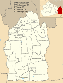
Walkfo: Visit Tandridge Places Map
14 tourist, history, culture & geography spots
Tandridge historic spots | Tandridge tourist destinations | Tandridge plaques | Tandridge geographic features |
| Walkfo Tandridge tourism map key: places to see & visit like National Trust sites, Blue Plaques, English Heritage locations & top tourist destinations in Tandridge | |||
Best Tandridge places to visit
Tandridge has places to explore by foot, bike or bus. Below are a selection of the varied Tandridge’s destinations you can visit with additional content available at the Walkfo Tandridge’s information audio spots:
 | Tandridge District Tandridge is a local government district in east Surrey. Its council is based in Oxted, although the largest settlement is Caterham. In mid-2019, the district had an estimated population of 88,129. |
 | Godstone railway station Godstone railway station is on the Redhill to Tonbridge Line and serves Godstone in Surrey, England. It is 28 miles 13 chains (45.32 km) measured from London Charing Cross via Redhill. The Bletchingley Tunnel less than one mile due west of the station is about ½ mile long. |
Visit Tandridge plaques
 1
1
plaques
here Tandridge has 1 physical plaques in tourist plaque schemes for you to explore via Walkfo Tandridge plaques audio map when visiting. Plaques like National Heritage’s “Blue Plaques” provide visual geo-markers to highlight points-of-interest at the places where they happened – and Walkfo’s AI has researched additional, deeper content when you visit Tandridge using the app. Experience the history of a location when Walkfo local tourist guide app triggers audio close to each Tandridge plaque. Explore Plaques & History has a complete list of Hartlepool’s plaques & Hartlepool history plaque map.


 Trying to encourage visitors to Tandridge?