Welcome to Visit Rowarth Places
The Walkfo guide to things to do & explore in Rowarth
 Visit Rowarth places using Walkfo for free guided tours of the best Rowarth places to visit. A unique way to experience Rowarth’s places, Walkfo allows you to explore Rowarth as you would a museum or art gallery with audio guides.
Visiting Rowarth Walkfo Preview
Rowarth is 2.5 miles (4 km) north of New Mills in the High Peak borough of Derbyshire. It is on the edge of the Peak District, in the hills between New Mills and Marple Bridge. Locally famous for the Little Mill Inn, a pub and restaurant in a former candlewick mill with a waterwheel in the adjacent stream. When you visit Rowarth, Walkfo brings Rowarth places to life as you travel by foot, bike, bus or car with a mobile phone & headphones.
Rowarth Places Overview: History, Culture & Facts about Rowarth
Visit Rowarth – Walkfo’s stats for the places to visit
With 28 audio plaques & Rowarth places for you to explore in the Rowarth area, Walkfo is the world’s largest heritage & history digital plaque provider. The AI continually learns & refines facts about the best Rowarth places to visit from travel & tourism authorities (like Wikipedia), converting history into an interactive audio experience.
Rowarth geography / climate
The hamlet is only accessible by car on one road. It is most commonly used by walkers who are going to nearby Lantern Pike and Kinder Scout. Peak District Boundary Walk runs through the village.
Why visit Rowarth with Walkfo Travel Guide App?
 You can visit Rowarth places with Walkfo Rowarth to hear history at Rowarth’s places whilst walking around using the free digital tour app. Walkfo Rowarth has 28 places to visit in our interactive Rowarth map, with amazing history, culture & travel facts you can explore the same way you would at a museum or art gallery with information audio headset. With Walkfo, you can travel by foot, bike or bus throughout Rowarth, being in the moment, without digital distraction or limits to a specific walking route. Our historic audio walks, National Trust interactive audio experiences, digital tour guides for English Heritage locations are available at Rowarth places, with a AI tour guide to help you get the best from a visit to Rowarth & the surrounding areas.
“Curated content for millions of locations across the UK, with 28 audio facts unique to Rowarth places in an interactive Rowarth map you can explore.”
Walkfo: Visit Rowarth Places Map
28 tourist, history, culture & geography spots
Rowarth historic spots | Rowarth tourist destinations | Rowarth plaques | Rowarth geographic features |
| Walkfo Rowarth tourism map key: places to see & visit like National Trust sites, Blue Plaques, English Heritage locations & top tourist destinations in Rowarth | |||
Best Rowarth places to visit
Rowarth has places to explore by foot, bike or bus. Below are a selection of the varied Rowarth’s destinations you can visit with additional content available at the Walkfo Rowarth’s information audio spots:
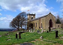
 | St Matthew’s Church, Hayfield St Matthew’s Church, Hayfield, Derbyshire, is a Grade II listed building . The church is built in local gritstone ashlar in an Early English Gothic style . It is also adjoined by a small church hall dating from 1977, erected over part of the graveyard . |
 | St. Thomas’ Church, Mellor St. Thomas’ Church is at the top of a lane overlooking the village of Mellor, Greater Manchester. It is recorded in the National Heritage List for England as a Grade II listed building. The church contains the oldest wooden pulpit in England and a late 12th-century Norman font. |
 | New Mills Town Hall New Mills Town Hall is a municipal building in New Mills, Derbyshire. It was opened in 1871 as a public hall for the Mechanics Institute. It became a town hall in 1895 upon the creation of New Mills Urban District Council. |
 | Etherow Country Park Etherow Country Park is situated at Compstall, England, between Marple Bridge and Romiley. It is a Local Nature Reserve and the starting point of the Goyt Way. Originally it was an industrial area incorporating a mine, a mill and a mill pond. |
 | Mellor hill fort Situated on a hill in Mellor, Greater Manchester, on the western edge of the Peak District, the hill fort overlooks the Cheshire Plain. Evidence exists of activity on the site as far back as 8,000 BC. |
Visit Rowarth plaques
 1
1
plaques
here Rowarth has 1 physical plaques in tourist plaque schemes for you to explore via Walkfo Rowarth plaques audio map when visiting. Plaques like National Heritage’s “Blue Plaques” provide visual geo-markers to highlight points-of-interest at the places where they happened – and Walkfo’s AI has researched additional, deeper content when you visit Rowarth using the app. Experience the history of a location when Walkfo local tourist guide app triggers audio close to each Rowarth plaque. Explore Plaques & History has a complete list of Hartlepool’s plaques & Hartlepool history plaque map.


 Trying to encourage visitors to Rowarth?