Welcome to Visit Oadby Places
The Walkfo guide to things to do & explore in Oadby
 Visit Oadby places using Walkfo for free guided tours of the best Oadby places to visit. A unique way to experience Oadby’s places, Walkfo allows you to explore Oadby as you would a museum or art gallery with audio guides.
Visiting Oadby Walkfo Preview
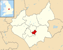
Oadby is three miles south east of Leicester city centre. The University of Leicester Botanical Garden is in Oad by. The Borough is twinned with Maromme in France, and Norderstedt in Germany. When you visit Oadby, Walkfo brings Oadby places to life as you travel by foot, bike, bus or car with a mobile phone & headphones.
Oadby Places Overview: History, Culture & Facts about Oadby
Visit Oadby – Walkfo’s stats for the places to visit
With 35 audio plaques & Oadby places for you to explore in the Oadby area, Walkfo is the world’s largest heritage & history digital plaque provider. The AI continually learns & refines facts about the best Oadby places to visit from travel & tourism authorities (like Wikipedia), converting history into an interactive audio experience.
Oadby history
Angles, Danes and Normans

Oadby is one of seventy Danish settlements in Leicestershire ending with “by” meaning “village” The name probably came from Old Norse Auðarbýr = “Auði’s settlement” The Middle Angles came under the rule of the kings of Mercia and were later conquered by the Danish invaders. The name must have existed long before the Danish invasions.
Modern times
Oadby remained a small settlement until the late 19th century when it became a fashionable suburb for the businessmen of Leicester. Some of the Framework Knitters Homes date back to 1909, while the North Memorial Homes, financed by Sir Jonathan North (former Mayor of Leicester) were built in 1927 and opened in the same year by the Prince of Wales.
Why visit Oadby with Walkfo Travel Guide App?
 You can visit Oadby places with Walkfo Oadby to hear history at Oadby’s places whilst walking around using the free digital tour app. Walkfo Oadby has 35 places to visit in our interactive Oadby map, with amazing history, culture & travel facts you can explore the same way you would at a museum or art gallery with information audio headset. With Walkfo, you can travel by foot, bike or bus throughout Oadby, being in the moment, without digital distraction or limits to a specific walking route. Our historic audio walks, National Trust interactive audio experiences, digital tour guides for English Heritage locations are available at Oadby places, with a AI tour guide to help you get the best from a visit to Oadby & the surrounding areas.
“Curated content for millions of locations across the UK, with 35 audio facts unique to Oadby places in an interactive Oadby map you can explore.”
Walkfo: Visit Oadby Places Map
35 tourist, history, culture & geography spots
Oadby historic spots | Oadby tourist destinations | Oadby plaques | Oadby geographic features |
| Walkfo Oadby tourism map key: places to see & visit like National Trust sites, Blue Plaques, English Heritage locations & top tourist destinations in Oadby | |||
Best Oadby places to visit
Oadby has places to explore by foot, bike or bus. Below are a selection of the varied Oadby’s destinations you can visit with additional content available at the Walkfo Oadby’s information audio spots:
 | County Hall F.C. County Hall Football Club is a football club based in Wigston, Leicestershire, England. They are currently members of the Leicesterhire Senior League Premier Division and play at Saffron Lane, groundsharing with Aylestone Park. |
 | Friar Lane & Epworth F.C. Friar Lane & Epworth F.C. are a football club based in Aylestone, a suburb of Leicester. They currently play in the Leicestershire Senior League Premier Division. They have reached the second round of the FA Cup twice in their short history. |
 | Oadby and Wigston Oadby and Wigston is a local government district and borough in Leicestershire. It was formed in 1974, under the Local Government Act 1972. The population of the district at the 2011 census was 56,170. The district forms part of the Harborough constituency. |
 | Wigston Wigston is a town in Leicestershire just south of Leicester on the A5199. It had a population of 32,321 in 2011. |
 | Leicester Racecourse Leicester Racecourse is a horse racing course in Oadby, Leicestershire. It is located about three miles south of the city centre. |
| GNG Oadby Town F.C. GNG Oadby Town Football Club is a Leicestershire association football club. The club plays in the United Counties League Premier Division South. |
 | St James the Greater, Leicester St James the Greater, Leicester is a Grade II* listed parish church in Leicester, Leicestershire. It is located south of the city centre of Leicester, on the London Road (A6), opposite Victoria Park. It has an active congregation and hosts a variety of events, having two church halls. |
 | Victoria Park, Leicester Victoria Park in Leicester is a public park of 69 acres (279,000 m) It is in the south-east of the city centre, backing on to the University of Leicester and close to the Leicester railway station. |
| Clarendon Park, Leicester Clarendon Park is part of Castle Ward and the constituency of Leicester South. It is bordered by Welford Road, London Road, Victoria Park and Victoria Park to the north and Avenue Road/Avenue Road Extension. |
| RAF Leicester East RAF Leicester East is a former Royal Air Force station. It was constructed in 1942 and formally opened in October 1943. The airfield is now Leicester Airport. |
Visit Oadby plaques
 2
2
plaques
here Oadby has 2 physical plaques in tourist plaque schemes for you to explore via Walkfo Oadby plaques audio map when visiting. Plaques like National Heritage’s “Blue Plaques” provide visual geo-markers to highlight points-of-interest at the places where they happened – and Walkfo’s AI has researched additional, deeper content when you visit Oadby using the app. Experience the history of a location when Walkfo local tourist guide app triggers audio close to each Oadby plaque. Explore Plaques & History has a complete list of Hartlepool’s plaques & Hartlepool history plaque map.


 Trying to encourage visitors to Oadby?