Welcome to Visit Limeside Places
The Walkfo guide to things to do & explore in Limeside
 Visit Limeside places using Walkfo for free guided tours of the best Limeside places to visit. A unique way to experience Limeside’s places, Walkfo allows you to explore Limeside as you would a museum or art gallery with audio guides.
Visiting Limeside Walkfo Preview
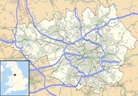
Limeside is a large housing estate in Oldham, Greater Manchester. It is 2 miles south of the town centre in the Hollinwood ward, contiguous with Failsworth, Hollins and Garden Suburb. Daisy Nook countryside park lies to the south. Whitebank Stadium, home of Oldham R.L.F.C. and North West Counties League football club Avro F.C., is in the estate. When you visit Limeside, Walkfo brings Limeside places to life as you travel by foot, bike, bus or car with a mobile phone & headphones.
Limeside Places Overview: History, Culture & Facts about Limeside
Visit Limeside – Walkfo’s stats for the places to visit
With 123 audio plaques & Limeside places for you to explore in the Limeside area, Walkfo is the world’s largest heritage & history digital plaque provider. The AI continually learns & refines facts about the best Limeside places to visit from travel & tourism authorities (like Wikipedia), converting history into an interactive audio experience.
Limeside history
Lime Side once constituted a hamlet and farmstead centred around Limeside Farm. The northern part of the estate was built by the early 1930s. The Oldham Extension Act 1950 transferred 605 acres (2.45 km) of the Limehurst Rural District to the County Borough of Oldham.
Why visit Limeside with Walkfo Travel Guide App?
 You can visit Limeside places with Walkfo Limeside to hear history at Limeside’s places whilst walking around using the free digital tour app. Walkfo Limeside has 123 places to visit in our interactive Limeside map, with amazing history, culture & travel facts you can explore the same way you would at a museum or art gallery with information audio headset. With Walkfo, you can travel by foot, bike or bus throughout Limeside, being in the moment, without digital distraction or limits to a specific walking route. Our historic audio walks, National Trust interactive audio experiences, digital tour guides for English Heritage locations are available at Limeside places, with a AI tour guide to help you get the best from a visit to Limeside & the surrounding areas.
“Curated content for millions of locations across the UK, with 123 audio facts unique to Limeside places in an interactive Limeside map you can explore.”
Walkfo: Visit Limeside Places Map
123 tourist, history, culture & geography spots
Limeside historic spots | Limeside tourist destinations | Limeside plaques | Limeside geographic features |
| Walkfo Limeside tourism map key: places to see & visit like National Trust sites, Blue Plaques, English Heritage locations & top tourist destinations in Limeside | |||
Best Limeside places to visit
Limeside has places to explore by foot, bike or bus. Below are a selection of the varied Limeside’s destinations you can visit with additional content available at the Walkfo Limeside’s information audio spots:
 | North Manchester Rugby Club North Manchester Rugby Club (aka North Manchester RUFC) is an amateur sports club situated 5 miles north of the centre of Manchester. Established originally in 1921 in Prestwich as Prestwich Rugby Union Football Club, the club moved to Rhodes Cricket Club in 1951 and changed its name to Prestwich & Middleton Rugby Union football club in 1985. In 1991 the club merged with struggling Oldham college Rugby Union Club, maintaining the name of North Manchester. |
| Chadderton F.C. Chadderton Football Club is a football club in Oldham, Greater Manchester. They are currently members of the North West Counties League Division One North and play at Andrew Street. |
 | Textile Mill, Chadderton Half of the building was destroyed by fire on 11 July 1950. The remaining section continued to be used for cotton waste sorting by W. H. Holt and Son until 1988. |
 | Cowhill, Greater Manchester Cowhill (archaically Cow Hill) is a locality of Chadderton, in the Metropolitan Borough of Oldham, Greater Manchester. It is located 0.5 miles (0.80 km) southeast of the town centre close to its eastern boundary with Oldham. An ancient hamlet which grew into an industrial village, Cowhill is now a residential area and includes a large housing development, Crossley Estate. |
 | Hartford Mill Hartford Mill was a Grade II-listed building located off Block Lane, in the Freehold area of Oldham, UK. The mill was located in the Oldham area of Freehold and is Grade II listed above Block Lane. |
 | Manor Mill, Chadderton Manor Mill, Chadderton is an early twentieth century, five storey cotton spinning mill. It was taken over by the Lancashire Cotton Corporation in the 1930s and passed to Courtaulds in 1964. Production finished in 1990. |
 | Werneth Park Werneth Park is a public park in Oldham, Greater Manchester. It includes a Grade II* listed Community Centre, Music Rooms, Dame Sarah Lees Memorial, Gardens and sports facilities. |
 | Werneth Hall Werneth Hall is a Grade II* listed privately owned Jacobean manor house in Oldham, Greater Manchester. It was built in 17th century and is now owned by a private family. |
 | Royd Mill, Oldham Royd Mill, Oldham was built in 1907 and extended in 1912 and 1924. It was taken over by the Lancashire Cotton Corporation in the 1930s and passed to Courtaulds in 1964. The mill was demolished in 2015 to make way for a housing scheme. |
 | Curzon Mill, Ashton-under-Lyne Curzon Mill, later known as Alger Mill, was a cotton spinning mill in the Hurst district of Ashton-under-Lyne, Greater Manchester. It was built between 1899 and 1902 for the Ashton Syndicate by Sydney Stott of Oldham. The mill was sold to the Alger Spinning Co. Ltd in 1911, and closed in 1942. |
Visit Limeside plaques
 16
16
plaques
here Limeside has 16 physical plaques in tourist plaque schemes for you to explore via Walkfo Limeside plaques audio map when visiting. Plaques like National Heritage’s “Blue Plaques” provide visual geo-markers to highlight points-of-interest at the places where they happened – and Walkfo’s AI has researched additional, deeper content when you visit Limeside using the app. Experience the history of a location when Walkfo local tourist guide app triggers audio close to each Limeside plaque. Explore Plaques & History has a complete list of Hartlepool’s plaques & Hartlepool history plaque map.


 Trying to encourage visitors to Limeside?