Welcome to Visit Grenofen Places
The Walkfo guide to things to do & explore in Grenofen
 Visit Grenofen places using Walkfo for free guided tours of the best Grenofen places to visit. A unique way to experience Grenofen’s places, Walkfo allows you to explore Grenofen as you would a museum or art gallery with audio guides.
Visiting Grenofen Walkfo Preview
Grenofen was mentioned as Grenefenne in 1238 in the Assize Rolls for Devon. It is located about 2 miles south of Tavistock on the A386 at the southwestern edge of Dartmoor National Park. When you visit Grenofen, Walkfo brings Grenofen places to life as you travel by foot, bike, bus or car with a mobile phone & headphones.
Grenofen Places Overview: History, Culture & Facts about Grenofen
Visit Grenofen – Walkfo’s stats for the places to visit
With 16 audio plaques & Grenofen places for you to explore in the Grenofen area, Walkfo is the world’s largest heritage & history digital plaque provider. The AI continually learns & refines facts about the best Grenofen places to visit from travel & tourism authorities (like Wikipedia), converting history into an interactive audio experience.
Grenofen geography / climate

The South Devon & Tavistock Railway was built by Brunel in the 1850s. The most northerly tunnel of the railway was located in Grenofen. Part of the track forms the Gem Bridge, crossing the River Walkham.
Why visit Grenofen with Walkfo Travel Guide App?
 You can visit Grenofen places with Walkfo Grenofen to hear history at Grenofen’s places whilst walking around using the free digital tour app. Walkfo Grenofen has 16 places to visit in our interactive Grenofen map, with amazing history, culture & travel facts you can explore the same way you would at a museum or art gallery with information audio headset. With Walkfo, you can travel by foot, bike or bus throughout Grenofen, being in the moment, without digital distraction or limits to a specific walking route. Our historic audio walks, National Trust interactive audio experiences, digital tour guides for English Heritage locations are available at Grenofen places, with a AI tour guide to help you get the best from a visit to Grenofen & the surrounding areas.
“Curated content for millions of locations across the UK, with 16 audio facts unique to Grenofen places in an interactive Grenofen map you can explore.”
Walkfo: Visit Grenofen Places Map
16 tourist, history, culture & geography spots
Grenofen historic spots | Grenofen tourist destinations | Grenofen plaques | Grenofen geographic features |
| Walkfo Grenofen tourism map key: places to see & visit like National Trust sites, Blue Plaques, English Heritage locations & top tourist destinations in Grenofen | |||
Best Grenofen places to visit
Grenofen has places to explore by foot, bike or bus. Below are a selection of the varied Grenofen’s destinations you can visit with additional content available at the Walkfo Grenofen’s information audio spots:
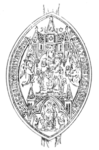
Tavistock Abbey
Nothing remains of the abbey except the refectory, two gateways and a porch. The abbey church, dedicated to Our Lady and St Rumon, was destroyed by Danish raiders in 997.

St Eustachius’ Church, Tavistock
St Eustachius’ Church, Tavistock is a Grade II* listed parish church in the Church of England Diocese of Exeter.

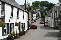
Crapstone
Crapstone is located on the edge of Dartmoor, in the parish of Buckland Monachorum. It is approximately 1 mile (1.6 km) from Yelverton and 9 miles (14 km) away from Plymouth.

River Walkham
The Walkham is a river whose source is on Dartmoor, Devon, England. It rises in the wide gap between Roos Tor and Great Mis Tor and flows almost due south for approximately 3 miles (4.8 km) The river then reaches a village, Horrabridge, with a small compact network of streets mainly on the south or left bank. Most of its tributaries are unnamed headwaters.

St Andrew’s Church, Buckland Monachorum
St Andrew’s Church is a Grade I listed parish church in Buckland Monachorum, Devon. It is in the Church of England Diocese of Exeter.
Buckland Monachorum
Buckland Monachorum is a village and civil parish in the West Devon district of Devon. It is situated on the River Tavy, about 10 miles north of Plymouth. The electoral ward of the same name gave a population of 3,380 at the 2011 census. The village is the site of St. Andrew’s, a 12th-century church with a Saxon baptismal font and the tombs of the Drake family.
Visit Grenofen plaques
 18
18
plaques
here Grenofen has 18 physical plaques in tourist plaque schemes for you to explore via Walkfo Grenofen plaques audio map when visiting. Plaques like National Heritage’s “Blue Plaques” provide visual geo-markers to highlight points-of-interest at the places where they happened – and Walkfo’s AI has researched additional, deeper content when you visit Grenofen using the app. Experience the history of a location when Walkfo local tourist guide app triggers audio close to each Grenofen plaque. Explore Plaques & History has a complete list of Hartlepool’s plaques & Hartlepool history plaque map.


 Trying to encourage visitors to Grenofen?