Welcome to Visit Dewsbury Places
The Walkfo guide to things to do & explore in Dewsbury
 Visit Dewsbury places using Walkfo for free guided tours of the best Dewsbury places to visit. A unique way to experience Dewsbury’s places, Walkfo allows you to explore Dewsbury as you would a museum or art gallery with audio guides.
Visiting Dewsbury Walkfo Preview
Dewsbury is a minster town within the Metropolitan Borough of Kirklees. It lies on the River Calder and an arm of the Calder and Hebble Navigation waterway. It is to the west of Wakefield, east of Huddersfield and south of Leeds. Historically a part of the West Riding of Yorkshire, after undergoing a period of major growth in the 19th century as a mill town. When you visit Dewsbury, Walkfo brings Dewsbury places to life as you travel by foot, bike, bus or car with a mobile phone & headphones.
Dewsbury Places Overview: History, Culture & Facts about Dewsbury
Visit Dewsbury – Walkfo’s stats for the places to visit
 With 47 audio plaques & Dewsbury places for you to explore in the Dewsbury area, Walkfo is the world’s largest heritage & history digital plaque provider. The AI continually learns & refines facts about the best Dewsbury places to visit from travel & tourism authorities (like Wikipedia), converting history into an interactive audio experience.
Dewsbury history
Toponymy
The Domesday Book of 1086 records the name as Deusberie, Deusberia, Deusbereia, or Deubire, literally “Dewi’s fort”, Dewi being an old Welsh name (equivalent to David) and “bury” coming from the old English word “burh”, meaning fort. Other theories exist as to the name’s origin.
Early history
In Anglo-Saxon times, Dewsbury was a centre of considerable importance. In 627 Paulinus, the Bishop of York, preached here on the banks of the River Calder. The first Methodist Society was established in 1746 and the Methodist tradition remained strong in the town.
Industrial Revolution
Dewsbury was a centre for the shoddy and mungo industries which recycled woollen items by mixing them with new wool and making heavy blankets and uniforms. The town benefited economically from the canal, its location at the heart of the Heavy Woollen District, and its proximity to coal mines. In the early 19th century, the town was centre of Luddite opposition to mechanisation in which workers retaliated against the mill owners.
Recent history
Massive immigration after 1960s left huge demographic impact on town, and it is ongoing today. Asian British and Muslims now make 1/3 of the population. Mohammad Sidique Khan, ringleader of the group responsible for the 7 July 2005 London bombings, lived in Lees Holm, Dewsbury.
Dewsbury culture & places
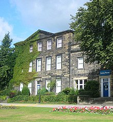
Dewsbury Museum was located within the mansion house in Crow Nest Park, before it closed to the public in November 2016. Nearby attractions include the National Coal Mining Museum for England, located in Overton, Wakefield.
Dewsbury geography / climate

Dewsbury is situated between Leeds and Bradford 8 miles (13 km) to the north, Huddersfield a similar distance to the south west, and Wakefield 6 mi (10 km) east. Geologically, the town is situated on rocks of the Carboniferous Period, consisting of coal measures and gritstones. The town centre is between 130 and 180 feet (40 and 55 metres) above sea level.
Divisions and suburbs
Dewsbury has a number of districts with different geographical and socio-economic patterns, they are, Chickenley, Crackenedge, Eastborough, Eightlands, Flatts, Ravensthorpe, Savile Town, Shaw Cross, Scout Hill, Thornhill Lees, Westborough, Westtown. Batley Carr, Hanging Heaton and Staincliffe have areas which lie in both Dewsburys and neighbouring Batley. Thornhill, Briestfield and Whitley are part of Dewsburg.
Why visit Dewsbury with Walkfo Travel Guide App?
 You can visit Dewsbury places with Walkfo Dewsbury to hear history at Dewsbury’s places whilst walking around using the free digital tour app. Walkfo Dewsbury has 47 places to visit in our interactive Dewsbury map, with amazing history, culture & travel facts you can explore the same way you would at a museum or art gallery with information audio headset. With Walkfo, you can travel by foot, bike or bus throughout Dewsbury, being in the moment, without digital distraction or limits to a specific walking route. Our historic audio walks, National Trust interactive audio experiences, digital tour guides for English Heritage locations are available at Dewsbury places, with a AI tour guide to help you get the best from a visit to Dewsbury & the surrounding areas.
“Curated content for millions of locations across the UK, with 47 audio facts unique to Dewsbury places in an interactive Dewsbury map you can explore.”
Walkfo: Visit Dewsbury Places Map
47 tourist, history, culture & geography spots
Dewsbury historic spots | Dewsbury tourist destinations | Dewsbury plaques | Dewsbury geographic features |
| Walkfo Dewsbury tourism map key: places to see & visit like National Trust sites, Blue Plaques, English Heritage locations & top tourist destinations in Dewsbury | |||
Best Dewsbury places to visit
Dewsbury has places to explore by foot, bike or bus. Below are a selection of the varied Dewsbury’s destinations you can visit with additional content available at the Walkfo Dewsbury’s information audio spots:

Foxsons Mill, Staincliffe
Foxsons Mill, Staincliffe was a doubling mill in Dewsbury, West Yorkshire. It doubled yarns of count’s 4’s to 40’s. It was taken over by Lancashire Cotton Corporation in the 1930s and passed to Courtaulds in 1964.

HWD Hospital Radio
HWD Hospital Radio broadcasts to patients and staff of Mid Yorkshire Trust hospitals. The station is registered as a charity with the Charity Commission for England and Wales, number 227515.

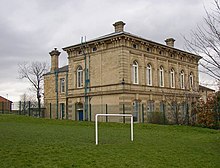
Batley Town Hall
Batley Town Hall is a municipal facility in the Market Place in Batley, West Yorkshire, England. It is a Grade II listed building.
Dewsbury
Dewsbury is a minster town within the Metropolitan Borough of Kirklees. It lies on the River Calder and an arm of the Calder and Hebble Navigation waterway. It is to the west of Wakefield, east of Huddersfield and south of Leeds. Historically a part of the West Riding of Yorkshire, after undergoing a period of major growth in the 19th century as a mill town.
Batley
Batley is a market and mill town in the Metropolitan Borough of Kirklees, in West Yorkshire. In 2011 the population of Batley including Hanging Heaton, Staincliffe, Carlinghow and Birstall Smithies, Copley Hill and Howden Clough was 48,730.

Dewsbury Bus Museum
The Dewsbury Bus Museum is a museum in Ravensthorpe, West Yorkshire, England. Opened to the public in September 1989, it is owned and operated by the West Riding Omnibus Museum Trust.

Thornhill power station
The first generating station on the site was owned and operated by the Yorkshire Electric Power Company. Following nationalisation of the British electricity supply industry in 1948 Thornhill power station was operated by a succession of state owned bodies. The coal-fired steam station was decommissioned in 1982, and was subsequently demolished in 1998.
Ossett Town A.F.C.
Ossett Town Association Football Club was an English football club based in Ossett in West Yorkshire. The club was based in the West Yorkshire town of Ossett.

Ossett United F.C.
Ossett United Football Club is a football club based in Ossett, West Yorkshire. They are currently members of the Northern Premier League Division One East.
Ossett Albion A.F.C.
Ossett Albion Association Football Club was an English football club. They played at Queen’s Terrace in Ossett, in West Yorkshire, more commonly known as Dimplewells.
Visit Dewsbury plaques
 7
7
plaques
here Dewsbury has 7 physical plaques in tourist plaque schemes for you to explore via Walkfo Dewsbury plaques audio map when visiting. Plaques like National Heritage’s “Blue Plaques” provide visual geo-markers to highlight points-of-interest at the places where they happened – and Walkfo’s AI has researched additional, deeper content when you visit Dewsbury using the app. Experience the history of a location when Walkfo local tourist guide app triggers audio close to each Dewsbury plaque. Explore Plaques & History has a complete list of Hartlepool’s plaques & Hartlepool history plaque map.


 Trying to encourage visitors to Dewsbury?