Welcome to Visit Crossmyloof Places The Walkfo guide to things to do & explore in Crossmyloof
Visit Crossmyloof places using Walkfo for free guided tours of the best Crossmyloof places to visit. A unique way to experience Crossmyloof’s places, Walkfo allows you to explore Crossmyloof as you would a museum or art gallery with audio guides.
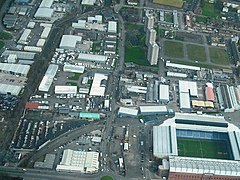
Visiting Crossmyloof Walkfo Preview Crossmyloof is an area on the south side of Glasgow situated between Pollokshields, Strathbungo and Shawlands in Scotland. It is situated between the districts of Pollok Shields and StrathBungo. Crossmaluif is a Scottish Gaelic area known as Crois Mo Liubha. When you visit Crossmyloof, Walkfo brings Crossmyloof places to life as you travel by foot, bike, bus or car with a mobile phone & headphones.
Crossmyloof Places Overview: History, Culture & Facts about Crossmyloof
Visit Crossmyloof – Walkfo’s stats for the places to visit
With 330 audio plaques & Crossmyloof places for you to explore in the Crossmyloof area, Walkfo is the world’s largest heritage & history digital plaque provider. The AI continually learns & refines facts about the best Crossmyloof places to visit from travel & tourism authorities (like Wikipedia), converting history into an interactive audio experience.
Crossmyloof history
The original village of Crossmyloof was situated in the north-western corner of Cathcart parish and was formed around the junction of what are now Pollokshaws Road and Langside Avenue (the road to Cathcart). Crossmyloof was a small hamlet which suddenly grew in prominence when Neale Thomson opened a large bakery there in 1847. Some remnants of this industrial past still endure. A bakery building behind the tenement known as Camphill Gate on Pollokshaws Road still stands, and there is still a road named Baker Street, where once stood the Alexander “Greek” Thomson-designed workers’ cottages. The main street in Crossmyloof was Cathcart Place, which is now part of Pollokshaws Road between the Langside Avenue/Minard Road junction and Shawlands Cross at the junction with Kilmarnock Road and Moss-side Road. A pub has occupied the Langside Avenue corner from the early 19th century: the Corona Bar, built there in 1912, carries a claim to have been established in 1817. Crossmyloof was little more than the main street until the late Victorian era, when Minard Road was opened up and the area around Waverley Gardens was built. For twenty years the tenements in Norham Street and Frankfort Street looked out on open countryside, dotted with ancient cottages, separating them from the Waverley Park area of Shawlands until the Waverley Scheme was constructed by Glasgow Corporation on the land opened up when Moss-side Road was formed to build Shawlands Academy. In 1818 Crossmyloof was described as the most populous village in Cathcart parish. Although till recently “remarkable chiefly for being a resort of vagrants”, the writer was happy to report that the village had now become more respectable from an increase in the number of its inhabitants, who now amounted to around 500. The remarks were a little premature, because in November 1820 two members of a band of armed ruffians who robbed a house in Crossmyloof were hanged in front of the Jail in the Saltmarket. The attack took place at the home of Dr Robert Watt, the author of the four volume Bibliotheca Britannica, who had died, allegedly of overwork, the previous year. His terrified widow had a pistol held at her head and her gold rings wrenched off her fingers. She is reported as having hastily left Crossmyloof for the safety of a home in Hutchesontown. When the Rev James Smith wrote his account of Cathcart parish in 1840, he used the name Westfield for the village and gave the number of families as 124 and the total population as 587 persons. At this period the villagers were mostly cotton handloom weavers. The only remaining woollen weaver was William AIgie, assisted by his seven children, three of whom wove woollen cloth, and four of whom worked in cotton. Two elderly women, Mary Sinclair, a muslin flowerer, and Margaret Wotherspoon, a muslin tambourer, were probably the last of the skilled embroideresses in the village. There were also a few shopkeepers, a blacksmith, several brassfounders and tinsmiths and William Ferguson, a lithographic engraver. By 1851 the population had risen sharply to 939 persons. The rise was accounted for by the establishment of the Crossmyloof Bakery in 1847 by Neale Thomson of Camphill. The following year James Muirhead moved his Cart Forge from its original site in the Skin Mill Yard at Pollokshaws to larger premises at Crossmyloof, where he produced axles for railway wagons. The Cart Forge was situated between Baker Street, where Thomson’s workforce was housed, and the Pollokshaws Road. Although most of the villagers lived along the Pollokshaws Road there was another small community in the area between Titwood Road and Moss-side Road. This area was known as Langside Valley and contained a few villas and cottages and several orchards and nurseries. This was where Glaswegians came in the Summer to enjoy fresh air and healthy surroundings. An advertisement in the Glasgow Courier of 25 February 1802 offers two “neat” lodgings at the village of Westfield for renting as summer quarters for “genteel families” from the city, who would find the houses well adapted for their use with the convenience of good water and a “neat” plot of ground. The villa owners included James Smellie, a retired cooper who occupied the house called Langside Valley, and William Jaffrey, an accountant and notary public and owner of Campvale House. Springhill House was the residence of Henry Murphy, a pawnbroker and hat manufacturer in the Bridgegate. The house later became Springhill Academy with William Cairns and William Christie as joint headmasters. Archibald McAuslan was the local surgeon and physician, and the community included a group of customs officers with the titles of outdoor officer, running officer, clerk, weigher and locker. When Hugh MacDonald passed through Crossmyloof on one of his Rambles in 1851, he found that the weavers of Crossmyloof and Strathbungo, like their neighbours on the hill above at Langside, were “celebrated growers of tulips, pansies, dahlias and other floricultural favourites” and met regularly at their florist clubs to examine choice flowers and discuss the best means of rearing them to perfection. Of these “bloom worshippers”, MacDonald writes: There are some sharp-sighted people who are said to see further into a millstone than their neighbours. For the truth of the saying we shall not venture to vouch; but most assuredly, for seeing into the mysteries of a tulip or a dahlia, we shall back a Crossmyloof or Strabungo weaver against the united amateurs of Scotland. In his report on the parish, the minister also explained that a “large and excellent school” under the patronage of Neale Thomson of Camphill, served the inhabitants of Crossmyloof and district, although it stood just across the boundary within Eastwood parish. The parish boundary was formed here by the Waterland stream, and its course can be traced between the ruinous remains of two old walls behind the school building on the north side of Skirving Street, now used as shops. Mr Smith describes how a number of years before, when there was no teacher for two years, the inhabitants, mostly weavers, formed themselves into an educational society to be managed by twelve directors under the presidency of the minister, and some of the “more intelligent” of the villagers undertook the task of teachers: a room was hired for the purpose, and a school opened from 8 to 10 o’clock at night, in which the teachers, two by two, in monthly turn, gave gratuitous instruction to whatever children were committed to their charge. The duty of the directors was principally to visit the school, and to wait upon careless parents to urge upon them the propriety of securing to their children the advantages which it offered. In 1877 the Cathcart School Board built Crossmyloof Public School in Stevenson (now Deanston) Drive. This school building has since been converted into flats. The first church to be erected in Crossmyloof was Langside Road Church (later Langside Avenue). This was built in 1859 for a United Presbyterian congregation which had been formed two years previously. The site at the corner of Baker Street and Langside Avenue was gifted by Neale Thomson. A new church was built on the same site in 1896. The congregation united with that of Shawlands Old in 1963 and the Langside Avenue buildings became St Helen’s Catholic Church. The Langside Halls stand nearby, on the edge of Queen’s Park. This building was originally the Bank of Glasgow, designed by John Gibson, when it stood in Queen Street in the centre of the city. In 1902-03 the building was relocated to its present site and converted to serve as public halls. Pollokshaws Road and Minard Road provided the shopping area for Crossmyloof, Shawlands and Langside – mainly in small shop units until the construction of the area’s first supermarket by the Co-operative during the 1960s.
Crossmyloof etymology
The name is reputed to be derived from its location on the route taken by Mary, Queen of Scots. A fortune-teller may have offered to tell the queen her fate if she would “cross her loof (hand) with silver”
Why visit Crossmyloof with Walkfo Travel Guide App?
You can visit Crossmyloof places with Walkfo Crossmyloof to hear history at Crossmyloof’s places whilst walking around using the free digital tour app. Walkfo Crossmyloof has 330 places to visit in our interactive Crossmyloof map, with amazing history, culture & travel facts you can explore the same way you would at a museum or art gallery with information audio headset. With Walkfo, you can travel by foot, bike or bus throughout Crossmyloof, being in the moment, without digital distraction or limits to a specific walking route. Our historic audio walks, National Trust interactive audio experiences, digital tour guides for English Heritage locations are available at Crossmyloof places, with a AI tour guide to help you get the best from a visit to Crossmyloof & the surrounding areas.
“Curated content for millions of locations across the UK, with 330 audio facts unique to Crossmyloof places in an interactive Crossmyloof map you can explore.”
Walkfo Crossmyloof tourism map key: places to see & visit like National Trust sites, Blue Plaques, English Heritage locations & top tourist destinations in Crossmyloof
Best Crossmyloof places to visit
Crossmyloof has places to explore by foot, bike or bus. Below are a selection of the varied Crossmyloof’s destinations you can visit with additional content available at the Walkfo Crossmyloof’s information audio spots:
Mansewood Mansewood (Scots: Mansewid) is a residential district in the Scottish city of Glasgow. It is situated south of the River Clyde and is surrounded by the districts of Eastwood, Hillpark, Pollokshaws in Glasgow and Thornliebank and Giffnock.
Muirend Muirend is situated about 4 miles (6.5 km) south of Glasgow city centre. The G44 postcode was rated as the most desirable area of Scotland to live in. Neighbouring areas include Cathcart, Merrylee and Newlands.
Cathcart Cemetery Cathcart Cemetery is a cemetery in East Renfrewshire, Scotland, which was opened in 1878 . It is named after the nearby neighbourhood of Cathcart on the southern outskirts of Glasgow, but does not actually fall within the city boundaries .
Strathbungo Strathbungo grew up as a small village built along the Pollokshaws Road, one of the main arteries leading southwards from the centre of Glasgow, adjoined by the Camphill Estate, now part of Queens Park. The feudal superiors, the Maxwells of Pollok, preferred the name Marchtown, and this name is seen on some old maps.
St Andrew’s Cross, Glasgow St Andrew’s Cross, also known as Eglinton Toll, is a road junction in the south side of Glasgow, Scotland. The junction is known as the St Andrew Cross.
Tradeston Tradeston (Scots: Tredstoun) is a small district in the Scottish city of Glasgow adjacent to the city centre on the south bank of the River Clyde.
Moorepark, Glasgow Moorepark is a small area in the Scottish city of Glasgow. Situated south of the River Clyde and part of the former Burgh of Govan. It was colloquially referred to as ‘Wine Alley’ during the 20th century.
Sandyford, Glasgow Sandyford is north of the River Clyde and forms part of the western periphery of Glasgow. Formerly the name of a ward under Glasgow Town Council in the early 20th century. It is within a continuous area of dense urban development bordering several other neighbourhoods.
1990 Auckland Jewish daycare stabbing A mentally ill woman attacked the playground of the Jewish Kadimah School’s daycare in Central Auckland, stabbing four children with a knife. The attack continued as other young students looked on “in horror”, while members of staff ran to help the children. The woman, 52-year-old Pauline Janet Williamson, was eventually disarmed by a male teacher. The children, aged 6 to 8, were hospitalised immediately afterwards.
Tradeston Flour Mills explosion The Tradeston Flour Mills exploded on 9 July 1872. Eighteen people died and at least 16 were injured. The mill was owned by Matthew Muir & Sons and had been in operation for 30 years.
Visit Crossmyloof plaques
52 plaques hereCrossmyloof has 52 physical plaques in tourist plaque schemes for you to explore via Walkfo Crossmyloof plaques audio map when visiting. Plaques like National Heritage’s “Blue Plaques” provide visual geo-markers to highlight points-of-interest at the places where they happened – and Walkfo’s AI has researched additional, deeper content when you visit Crossmyloof using the app. Experience the history of a location when Walkfo local tourist guide app triggers audio close to each Crossmyloof plaque. Explore Plaques & History has a complete list of Hartlepool’s plaques & Hartlepool history plaque map.
Experience Crossmyloof audio walks & tours
Walkfo guides for things to do / places to visit in Crossmyloof allows exploration as you would do an art gallery or museum. Walk close to one of Crossmyloof’s 330 historic places & our digital tour guide will create an audio story for that spot. With headphone connected, you can explore Crossmyloof freely by foot, bike or bus – with your own personal tour guide in your pocket.
Explore Crossmyloof Map App
Our visit Crossmyloof map shows you things-to-do & places you can visit in Crossmyloof & surrounding areas using the Walkfo digital audio tour guide app. Each spot has plaque, building, street or area information on history, culture or tourism.
You can set your Walkfo’s Crossmyloof tourist map to find historic & tourism spots within 1km, 3km & 5km of the Crossmyloof centre, depending on how far you plan to explore whilst you visit Crossmyloof area at LONG:-4.288071, LAT:55.835313.
Walkfo App
Walkfo
Walkfo is free to download & use (for a limited time period), so if you are looking to explore Crossmyloof, go to your App Store to search for “Walkfo” or follow a links below and install on your mobile phone. Walkfo is designed for use with headphones or AirPods, so you can walk & explore whilst learning about the things around you without digital distraction.
● Millbrae Crescent ● Couper Institute Library ● Holmwood House ● Cathcart ● Linn Park, Glasgow ● Langside ● Cathcart Castle ● Battlefield, Glasgow ● Simshill ● Battle of Langside ● Cathcart Old Church ● Glasgow Victoria Infirmary ● Mount Florida ● Lesser Hampden ● New Victoria Hospital ● Queen’s Park, Glasgow ● Hampden Park ● Scottish Football Hall of Fame ● Hampden Park (1873–83) ● King’s Park, Glasgow ● Crosshill Queen’s Park Church ● Camphill Queen’s Park Baptist Church ● Queen’s Park Govanhill Parish Church ● Langside Synagogue ● Toryglen Regional Football Centre ● Crossmyloof ● Titwood ● Crosshill, Glasgow ● Strathbungo ● Category Is Books ● Corkerhill ● Corkerhill Carriage Servicing Maintenance Depot ● St James’ (Pollok) Parish Church ● Toryglen ● Rutherglen Glencairn F.C. ● Cathkin Park (1872–1903) ● Fireworks Village ● Govanhill Trinity Church ● Govanhill Picture House ● Strathbungo Parish Church ● Govanhill ● Govanhill Baths ● Polmadie TRSMD ● Haggs Castle ● Rosebery Park ● Pollokshields Burgh Hall ● Pollokshields ● Sherbrooke Mosspark Church ● Shields Junction ● Pollokshields Parish Church ● Pollokshields Library ● Kinning Park (sports ground) ● Bellahouston ● Ibrox Parish Church ● Walmer Crescent ● Cessnock, Glasgow ● Tramway (arts centre) ● Kinning Park ● St Ninian’s, Pollokshields, Glasgow ● Glasgow Garden Festival ● House for an Art Lover ● Plantation, Glasgow ● Bellahouston Park ● Empire Exhibition, Scotland ● Royal Samaritan Hospital ● Tait Tower ● St Andrew’s Cross, Glasgow ● Ibrox Park (1887–99) ● Ibrox Stadium ● Kingston, Glasgow ● 1902 Ibrox disaster ● Govan Town Hall ● Pacific Quay ● BBC Radio Scotland ● BBC Pacific Quay ● Media Village Scotland ● Glasgow Science Centre ● Bell’s Bridge ● Glasgow Seaplane Terminal ● Glasgow Harbour Tunnel Rotundas ● Kingston Bridge, Glasgow ● Millennium Bridge, Glasgow ● Glasgow Tower ● SEC Armadillo ● Crowne Plaza Glasgow ● Tradeston ● Moorepark, Glasgow ● Laurieston, Glasgow ● New Bedford Cinema ● SSE Hydro ● NHS Louisa Jordan Hospital ● SEC Centre ● Mosspark ● Tradeston Bridge ● HMS Dalriada ● Finnieston ● Finnieston distillery ● Broomielaw ● Glasgow, Paisley and Johnstone Canal ● Gorbals ● Rossvale F.C. ● Glasgow Girls F.C. ● George V Bridge, Glasgow ● The Pyramid at Anderston ● Argyle Building, Glasgow ● Craigton, Glasgow ● TAG Theatre Company ● Caledonian Railway Bridge ● Citizens Theatre ● Glasgow Bridge, Glasgow ● Anderston Centre ● Kelvinhaugh, Glasgow ● Glasgow Sheriff Court ● Halfway, Glasgow ● Southern Necropolis ● Sandyford Henderson Memorial Church ● Adelphi Whisky ● Yorkhill Parade drill hall ● Optimo ● Glasgow Central Mosque ● New Govan Parish Church ● Sandyford, Glasgow ● The Tron Church at Kelvingrove ● Classic Grand ● Elphinstone Place ● Victoria Bridge, Glasgow ● Glenlee (ship) ● The Glasgow Gaiety Theatre ● St Andrew’s Cathedral, Glasgow ● Glasgow (district) ● The Metropole Theatre ● 2013 Glasgow helicopter crash ● The Briggait ● Glasgow Women’s Library ● Glasgow St Enoch rail accident ● St. Enoch Centre ● The 13th Note Café ● City Union Bridge ● Glasgow Print Studio ● Merchant City ● Sharmanka Kinetic Gallery ● Saltmarket ● Collegiate Church of the Blessed Virgin Mary and St Anne, Glasgow ● Tron Theatre ● Trongate ● Tobacco Merchant’s House ● Albert Bridge, Glasgow ● Candleriggs ● St Enoch Square ● St Andrew’s-by-the-Green ● Merchant City Festival ● Clyde Model Dockyard ● St Andrew’s Square, Glasgow ● St Andrew’s in the Square ● Princes Square ● Glasgay! Festival ● Glasgow LGBT Centre ● Glasgow City Halls ● 2014 Glasgow bin lorry crash ● Equestrian statue of the Duke of Wellington, Glasgow ● Hutchesons’ Hall ● Queens Theatre, Glasgow ● Gallery of Modern Art, Glasgow ● Royal Exchange Square ● The Ramshorn ● Clyde Amateur Rowing Club ● Clydesdale Amateur Rowing Club ● The Lighthouse, Glasgow ● Glasgow International Comedy Festival ● World Pipe Band Championships ● Glasgow ● Ramshorn Cemetery ● Glasgow City Chambers ● George Square ● The Egyptian Halls ● The Arches (Glasgow) ● Ca d’Oro Building ● Turing Institute ● University of Strathclyde Technology and Innovation Centre ● The Horse Shoe Bar ● Nelson Monument, Glasgow ● Glasgow Stock Exchange ● St George’s Tron Church ● University of Strathclyde Students’ Association ● Greater Glasgow ● James Weir Building ● Royal Faculty of Procurators in Glasgow ● Alhambra Theatre Glasgow ● TRNSMT ● Glasgow International Jazz Festival ● Barrowland Ballroom ● Glasgow city centre ● Glasgow hotel stabbings ● Royal Conservatoire of Scotland ● Green’s Playhouse ● Strathclyde Grain distillery ● People’s Palace, Glasgow ● Kinclaith ● Lion Chambers ● Hutchesontown ● Glasgow Royal Concert Hall ● Glasgow Empire Theatre ● St Andrew House, Glasgow ● Cineworld Glasgow ● Royalty Theatre, Glasgow ● The Apollo (Glasgow) ● Pavilion Theatre (Glasgow) ● Templeton On The Green ● Burns Howff ● Glasgow Green ● Glasgow University Boat Club ● Blythswood Square ● Archdiocese of Glasgow ● King’s Bridge, Glasgow ● Theatre Royal, Glasgow ● King Tut’s Wah Wah Hut ● Edinburgh Folk Club ● Blythswood Hill ● Willow Tearooms ● Glasgow Art Club ● Royal Glasgow Institute of the Fine Arts ● St Columba Church of Scotland, Glasgow ● Glasgow Film Theatre ● Adelaide Place Baptist Church ● McLellan Galleries ● Partick Cross ● Partick Castle ● Archives of the University of Glasgow ● Western Infirmary ● Glasgow Museum of Transport ● West Glasgow Ambulatory Care Hospital ● Kelvin Hall International Sports Arena ● Kelvin Hall ● Riverside Museum ● Cameronians War Memorial ● River Kelvin ● Govan-Partick Bridge ● Kelvingrove Art Gallery and Museum ● Govan Old Parish Church ● Govandale Park ● Kelvingrove Park ● International Exhibition of Science, Art and Industry ● CaVa Studios ● Govan Shipbuilders ● Kelvingrove, Glasgow ● Fairfield Offices ● Park District, Glasgow ● 22 Park Circus, Glasgow ● Elder Park, Govan ● St. Jude’s Church, Glasgow ● Curtain Theatre (Glasgow) ● St George’s Cross, Glasgow ● Mitchell Library ● Charing Cross, Glasgow ● Elmbank Gardens ● Anderston ● Tenement House (Glasgow) ● The Garage, Glasgow ● Oatlands, Glasgow ● Braehead Park ● Rutherglen Bridge ● Polmadie Bridge ● Glasgow Rowing Club ● Glasgow National Hockey Centre ● Drumoyne ● Craigton Cemetery ● King’s Theatre, Glasgow ● Beresford Hotel ● St Andrew’s West, Glasgow ● Garnethill Synagogue ● Garnethill ● Haldane Building ● St Aloysius Church, Glasgow ● O2 ABC Glasgow ● Centre for Contemporary Arts ● Giffnock ● Netherlee ● Scottish Football Museum ● Cathkin Park ● Pollok ● Polmadie ● Dumbreck ● Ibrox, Glasgow ● 1971 Ibrox disaster ● Finnieston Crane ● Benburb F.C. ● Sub Club ● Hielanman’s Umbrella ● Hutchesontown C ● Grand Central Hotel (Glasgow) ● Celtic Connections ● Calton, Glasgow ● 1990 Auckland Jewish daycare stabbing ● Tradeston Flour Mills explosion ● Clydeside distillery ● Britannia Music Hall ● 2021 United Nations Climate Change Conference ● Strathclyde University Boat Club
Getting to / around Crossmyloof – transport link, station & street map
Getting around in Crossmyloof using public transportation may include road, street, train, underground, bus or tram transport options. Walkfo has identified the following Crossmyloof places with historic / cultural / factual content when you visit:
Local Crossmyloof Public Transport Stations
Crossmyloof Notable Streets & Road Destinations
Thornliebank railway station
Kennishead railway station
Giffnock railway station
Pollokshaws West railway station
Muirend railway station
Pollokshaws East railway station
Langside railway station
Cathcart railway station
Shawlands railway station
Mount Florida railway station
King’s Park railway station
Crossmyloof railway station
Queens Park railway station (Scotland)
Crosshill railway station
Pollokshields West railway station
Strathbungo railway station
Corkerhill railway station
Maxwell Park railway station
Dumbreck railway station
Bellahouston railway station
Kinning Park subway station
Pollokshields railway station
Shields railway station
Shields Road railway station
Pollokshields East railway station
Cessnock subway station
Shields Road subway station
Ibrox railway station
Bellahouston Park Halt railway station
Ibrox subway station
West Street subway station
Eglinton Street railway station
Southside railway station
Cumberland Street railway station
Bridge Street subway station
Bridge Street railway station
Main Street railway station (Glasgow)
Gorbals railway station
Anderston railway station
Finnieston railway station
Govan railway station
Govan subway station
Glasgow Central station
St Enoch subway station
Argyle Street railway station
St Enoch railway station
Gallowgate railway station
Glasgow Queen Street railway station
Buchanan Street subway station
Glasgow Green railway station
Partick Central railway station
Charing Cross (Glasgow) railway station
Cardonald railway station
Mosspark railway station
Exhibition Centre railway station
Gushetfaulds railway station
Glasgow Shields Road TMD
Victoria Road drill hall
Kilbirnie Street fire
Cheapside Street whisky bond fire
James Watt Street fire
South Portland Street Suspension Bridge
Yorkhill Street drill hall
Argyle Street, Glasgow
Dunlop Street
Glassford Street
Wilson Street
Queen Street, Glasgow
Cochrane Street, Glasgow
Buchanan Street
High Street, Glasgow
St Vincent Street Church, Glasgow
Sauchiehall Street
Ingram Street
[transportsummary]
Local Crossmyloof historians & Crossmyloof tour guides
Trying to encourage visitors to Crossmyloof? Walkfo has millions audio places already available but Walkfo Creator gives Crossmyloof’s places, attractions & landmarks ability to create their own unique outdoor audio museums & using our simple & easy to use Walkfo Creator. – Creating a new audio experience for your Crossmyloof place is free* and quick (15+ minutes if you prepare text content) to use, with Walkfo Creator doing the hard work of generating AI audio files for geo-spots from the text you provide with a simply click on a map. – The 100 Amazing Crossmyloof Places is just one example of an outdoor museum created using Walkfo Creator (pictured to the left) for people to safely explore during Covid-19 times whilst visiting a city. Our tool is open to tourism organisations, travel destinations & National Trust locations to create their own audio walks to offer free when people visit Crossmyloof destinations. – Walkfo itself is looking to partner with websites offering things-to-do / what’s on events listings to enhance the content of our ‘visit-Crossmyloof’ web pages (for example: www.visitCrossmyloof.com). If you are interested in partnering, please contact us to discuss options.
* Walkfo Creator is free to use for a limited number of audio spots within a map with a license fee applicable when more than 20 audio spots within location walk are created. v1.1336
 Visit Crossmyloof places using Walkfo for free guided tours of the best Crossmyloof places to visit. A unique way to experience Crossmyloof’s places, Walkfo allows you to explore Crossmyloof as you would a museum or art gallery with audio guides.
 You can visit Crossmyloof places with Walkfo Crossmyloof to hear history at Crossmyloof’s places whilst walking around using the free digital tour app. Walkfo Crossmyloof has 330 places to visit in our interactive Crossmyloof map, with amazing history, culture & travel facts you can explore the same way you would at a museum or art gallery with information audio headset. With Walkfo, you can travel by foot, bike or bus throughout Crossmyloof, being in the moment, without digital distraction or limits to a specific walking route. Our historic audio walks, National Trust interactive audio experiences, digital tour guides for English Heritage locations are available at Crossmyloof places, with a AI tour guide to help you get the best from a visit to Crossmyloof & the surrounding areas.


 52
52


 Trying to encourage visitors to Crossmyloof?