Welcome to Visit Corbridge Places
The Walkfo guide to things to do & explore in Corbridge
 Visit Corbridge places using Walkfo for free guided tours of the best Corbridge places to visit. A unique way to experience Corbridge’s places, Walkfo allows you to explore Corbridge as you would a museum or art gallery with audio guides.
Visiting Corbridge Walkfo Preview
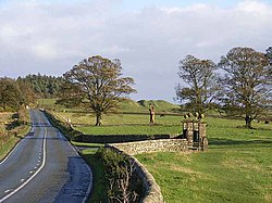
Corbridge is 16 miles (26 km) west of Newcastle and 4 miles (6 km) east of Hexham. Villages nearby include Halton, Acomb, Aydon and Sandhoe. When you visit Corbridge, Walkfo brings Corbridge places to life as you travel by foot, bike, bus or car with a mobile phone & headphones.
Corbridge Places Overview: History, Culture & Facts about Corbridge
Visit Corbridge – Walkfo’s stats for the places to visit
With 19 audio plaques & Corbridge places for you to explore in the Corbridge area, Walkfo is the world’s largest heritage & history digital plaque provider. The AI continually learns & refines facts about the best Corbridge places to visit from travel & tourism authorities (like Wikipedia), converting history into an interactive audio experience.
Corbridge history
Roman fort and town

Coria was the most northerly town in the Roman Empire, lying at the junction of Stanegate and Dere Street. The first fort was established c. AD 85, although there was a slightly earlier base nearby at Beaufront Red House. The best-known finds from the site include the stone Corbridge Lion and the Corbridge Hoard of armour and sundry other items.
Buildings

The Church of St Andrew’s is thought to have been consecrated in 676. The entrance to the Church is through glass doors given by Rowan Atkinson (known for Blackadder and Mr Bean) The Vicar’s Pele is to be found in the south-east corner of the churchyard.
Border warfare
Corbridge suffered from border warfare which was prevalent between 1300 and 1700. Raids were commonplace and livestock was brought into the town at night. A bridge over the Tyne was built in the 13th century, but this original has not survived. The present bridge, an impressive stone structure with seven arches, was erected in 1674.
Corbridge etymology
Corbridge was known to the Romans as something like Corstopitum or Coriosopitum. Wooden writing tablets found at the Roman fort of Vindolanda suggest it was locally called Coria (meaning a tribal centre)
Why visit Corbridge with Walkfo Travel Guide App?
 You can visit Corbridge places with Walkfo Corbridge to hear history at Corbridge’s places whilst walking around using the free digital tour app. Walkfo Corbridge has 19 places to visit in our interactive Corbridge map, with amazing history, culture & travel facts you can explore the same way you would at a museum or art gallery with information audio headset. With Walkfo, you can travel by foot, bike or bus throughout Corbridge, being in the moment, without digital distraction or limits to a specific walking route. Our historic audio walks, National Trust interactive audio experiences, digital tour guides for English Heritage locations are available at Corbridge places, with a AI tour guide to help you get the best from a visit to Corbridge & the surrounding areas.
“Curated content for millions of locations across the UK, with 19 audio facts unique to Corbridge places in an interactive Corbridge map you can explore.”
Walkfo: Visit Corbridge Places Map
19 tourist, history, culture & geography spots
Corbridge historic spots | Corbridge tourist destinations | Corbridge plaques | Corbridge geographic features |
| Walkfo Corbridge tourism map key: places to see & visit like National Trust sites, Blue Plaques, English Heritage locations & top tourist destinations in Corbridge | |||
Best Corbridge places to visit
Corbridge has places to explore by foot, bike or bus. Below are a selection of the varied Corbridge’s destinations you can visit with additional content available at the Walkfo Corbridge’s information audio spots:

Devil’s Water
Devil’s Water is a tributary of the River Tyne. It joins the River from the south, near the village of Dilston. It is formed from the waters of several smaller burns and sikes between Embley and Hackford some 5 miles south of Hexham.

Dilston Castle
Dilston Castle is a ruined 15th-century tower house situated at Dilston, near Corbridge, Northumberland, England. A three-storey tower was built by Sir William Claxton on the site of an earlier pele tower in the 15th century.
Hunnum
Hunnum (also known as Onnum) was a Roman fort north of the modern-day village of Halton, Northumberland. It was the fifth fort on Hadrian’s Wall, after Segedunum, Pons Aelius, Condercum and Vindobala. The Latinized Brittonic name “Onnum” may mean “Stream/Water”, “Ash (tree)” or “Rock”
Visit Corbridge plaques
 1
1
plaques
here Corbridge has 1 physical plaques in tourist plaque schemes for you to explore via Walkfo Corbridge plaques audio map when visiting. Plaques like National Heritage’s “Blue Plaques” provide visual geo-markers to highlight points-of-interest at the places where they happened – and Walkfo’s AI has researched additional, deeper content when you visit Corbridge using the app. Experience the history of a location when Walkfo local tourist guide app triggers audio close to each Corbridge plaque. Explore Plaques & History has a complete list of Hartlepool’s plaques & Hartlepool history plaque map.


 Trying to encourage visitors to Corbridge?