Welcome to Visit Chisworth Places The Walkfo guide to things to do & explore in Chisworth
Visit Chisworth places using Walkfo for free guided tours of the best Chisworth places to visit. A unique way to experience Chisworth’s places, Walkfo allows you to explore Chisworth as you would a museum or art gallery with audio guides.
Visiting Chisworth Walkfo Preview Chisworth is 3 miles south-west of Glossop town centre, on the south side of the Etherow valley. In 1901, it had a population of 409. In June 1930, a local cloudburst caused flooding that killed one man. When you visit Chisworth, Walkfo brings Chisworth places to life as you travel by foot, bike, bus or car with a mobile phone & headphones.
Chisworth Places Overview: History, Culture & Facts about Chisworth
Visit Chisworth – Walkfo’s stats for the places to visit
With 38 audio plaques & Chisworth places for you to explore in the Chisworth area, Walkfo is the world’s largest heritage & history digital plaque provider. The AI continually learns & refines facts about the best Chisworth places to visit from travel & tourism authorities (like Wikipedia), converting history into an interactive audio experience.
Why visit Chisworth with Walkfo Travel Guide App?
You can visit Chisworth places with Walkfo Chisworth to hear history at Chisworth’s places whilst walking around using the free digital tour app. Walkfo Chisworth has 38 places to visit in our interactive Chisworth map, with amazing history, culture & travel facts you can explore the same way you would at a museum or art gallery with information audio headset. With Walkfo, you can travel by foot, bike or bus throughout Chisworth, being in the moment, without digital distraction or limits to a specific walking route. Our historic audio walks, National Trust interactive audio experiences, digital tour guides for English Heritage locations are available at Chisworth places, with a AI tour guide to help you get the best from a visit to Chisworth & the surrounding areas.
“Curated content for millions of locations across the UK, with 38 audio facts unique to Chisworth places in an interactive Chisworth map you can explore.”
Walkfo Chisworth tourism map key: places to see & visit like National Trust sites, Blue Plaques, English Heritage locations & top tourist destinations in Chisworth
Best Chisworth places to visit
Chisworth has places to explore by foot, bike or bus. Below are a selection of the varied Chisworth’s destinations you can visit with additional content available at the Walkfo Chisworth’s information audio spots:
Brabyns Park Brabyns Park is a public park in Marple Bridge, Stockport, Greater Manchester, England. It is located on the outskirts of the city of Stockport.
St. Thomas’ Church, Mellor St. Thomas’ Church is at the top of a lane overlooking the village of Mellor, Greater Manchester. It is recorded in the National Heritage List for England as a Grade II listed building. The church contains the oldest wooden pulpit in England and a late 12th-century Norman font.
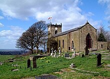
St Michael and All Angels Church, Mottram St Michael and All Angels Church stands on Warhill overlooking the village of Mottram in Longdendale, Greater Manchester. The church is recorded in the National Heritage List for England as a Grade II* listed building. It is an active Anglican parish church in the diocese of Chester and the archdeaconry of Macclesfield.
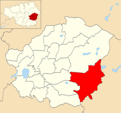
Longdendale (ward) Longdendale is an electoral ward of Tameside, England. It is represented in Westminster by Jonathan Reynolds Labour Co-operative MP Jonathan Reynolds.
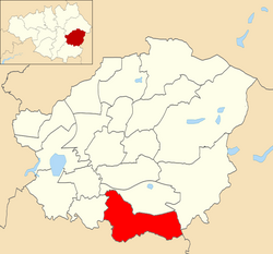
Hyde Werneth (ward) Hyde Werneth is an electoral ward of Tameside, England. It is represented in Westminster by Jonathan Reynolds Labour Co-operative MP Jonathan Reynolds.
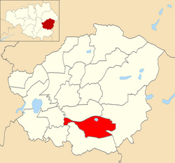
Hyde Godley (ward) Hyde Godley is an electoral ward of Tameside, England. It is represented in Westminster by Jonathan Reynolds Labour Co-operative MP Jonathan Reynolds.
Werneth Low Werneth Low is a hill in Greater Manchester, England, and a part of the Pennines. It is located on the borders of Stockport and Tameside, rising to a height of 279 metres (915 ft) The term “low” does not refer to any lack of altitude, it being a northern English word for hill.
Etherow Country Park Etherow Country Park is situated at Compstall, England, between Marple Bridge and Romiley. It is a Local Nature Reserve and the starting point of the Goyt Way. Originally it was an industrial area incorporating a mine, a mill and a mill pond.
Mellor hill fort Situated on a hill in Mellor, Greater Manchester, on the western edge of the Peak District, the hill fort overlooks the Cheshire Plain. Evidence exists of activity on the site as far back as 8,000 BC.
Visit Chisworth plaques
6 plaques hereChisworth has 6 physical plaques in tourist plaque schemes for you to explore via Walkfo Chisworth plaques audio map when visiting. Plaques like National Heritage’s “Blue Plaques” provide visual geo-markers to highlight points-of-interest at the places where they happened – and Walkfo’s AI has researched additional, deeper content when you visit Chisworth using the app. Experience the history of a location when Walkfo local tourist guide app triggers audio close to each Chisworth plaque. Explore Plaques & History has a complete list of Hartlepool’s plaques & Hartlepool history plaque map.
Experience Chisworth audio walks & tours
Walkfo guides for things to do / places to visit in Chisworth allows exploration as you would do an art gallery or museum. Walk close to one of Chisworth’s 38 historic places & our digital tour guide will create an audio story for that spot. With headphone connected, you can explore Chisworth freely by foot, bike or bus – with your own personal tour guide in your pocket.
Explore Chisworth Map App
Our visit Chisworth map shows you things-to-do & places you can visit in Chisworth & surrounding areas using the Walkfo digital audio tour guide app. Each spot has plaque, building, street or area information on history, culture or tourism.
You can set your Walkfo’s Chisworth tourist map to find historic & tourism spots within 1km, 3km & 5km of the Chisworth centre, depending on how far you plan to explore whilst you visit Chisworth area at LONG:-2.015, LAT:53.426.
Walkfo App
Walkfo
Walkfo is free to download & use (for a limited time period), so if you are looking to explore Chisworth, go to your App Store to search for “Walkfo” or follow a links below and install on your mobile phone. Walkfo is designed for use with headphones or AirPods, so you can walk & explore whilst learning about the things around you without digital distraction.
Things to do & visit in Chisworth / surrounding areas
● Church of St Martin, Marple ● Marple Lock Flight ● Brabyns Park ● Marple Bridge ● Compstall ● Goyt Way ● St. Thomas’ Church, Mellor ● Mellor, Greater Manchester ● Ludworth, Greater Manchester ● Ardotalia ● Mottram in Longdendale ● Gamesley ● St Michael and All Angels Church, Mottram ● Mottram in Longdendale (ancient parish) ● Longendale Urban District ● Longdendale (ward) ● Dinting Vale ● Dinting Viaduct ● Broadbottom Viaduct ● Broadbottom ● Hattersley ● Charlesworth, Derbyshire ● Simmondley ● Gee Cross ● Hyde Werneth (ward) ● Mottram Tunnel ● Hyde Godley (ward) ● Backbower ● Werneth Low ● Holehouse
● Chisworth ● Etherow Country Park ● Brown Low ● Ludworth Intake ● Rowarth ● Mellor hill fort
Getting to / around Chisworth – transport link, station & street map
Getting around in Chisworth using public transportation may include road, street, train, underground, bus or tram transport options. Walkfo has identified the following Chisworth places with historic / cultural / factual content when you visit:
Local Chisworth Public Transport Stations
Chisworth Notable Streets & Road Destinations
Marple railway station
Godley railway station
Dinting railway station
Godley East railway station
Hattersley railway station
Broadbottom railway station
[transportsummary]
Local Chisworth historians & Chisworth tour guides
Trying to encourage visitors to Chisworth? Walkfo has millions audio places already available but Walkfo Creator gives Chisworth’s places, attractions & landmarks ability to create their own unique outdoor audio museums & using our simple & easy to use Walkfo Creator. – Creating a new audio experience for your Chisworth place is free* and quick (15+ minutes if you prepare text content) to use, with Walkfo Creator doing the hard work of generating AI audio files for geo-spots from the text you provide with a simply click on a map. – The 100 Amazing Chisworth Places is just one example of an outdoor museum created using Walkfo Creator (pictured to the left) for people to safely explore during Covid-19 times whilst visiting a city. Our tool is open to tourism organisations, travel destinations & National Trust locations to create their own audio walks to offer free when people visit Chisworth destinations. – Walkfo itself is looking to partner with websites offering things-to-do / what’s on events listings to enhance the content of our ‘visit-Chisworth’ web pages (for example: www.visitChisworth.com). If you are interested in partnering, please contact us to discuss options.
* Walkfo Creator is free to use for a limited number of audio spots within a map with a license fee applicable when more than 20 audio spots within location walk are created. v1.1336
 Visit Chisworth places using Walkfo for free guided tours of the best Chisworth places to visit. A unique way to experience Chisworth’s places, Walkfo allows you to explore Chisworth as you would a museum or art gallery with audio guides.
 You can visit Chisworth places with Walkfo Chisworth to hear history at Chisworth’s places whilst walking around using the free digital tour app. Walkfo Chisworth has 38 places to visit in our interactive Chisworth map, with amazing history, culture & travel facts you can explore the same way you would at a museum or art gallery with information audio headset. With Walkfo, you can travel by foot, bike or bus throughout Chisworth, being in the moment, without digital distraction or limits to a specific walking route. Our historic audio walks, National Trust interactive audio experiences, digital tour guides for English Heritage locations are available at Chisworth places, with a AI tour guide to help you get the best from a visit to Chisworth & the surrounding areas.


 6
6


 Trying to encourage visitors to Chisworth?