Welcome to Visit Chilwell Places
The Walkfo guide to things to do & explore in Chilwell
 Visit Chilwell places using Walkfo for free guided tours of the best Chilwell places to visit. A unique way to experience Chilwell’s places, Walkfo allows you to explore Chilwell as you would a museum or art gallery with audio guides.
Visiting Chilwell Walkfo Preview
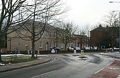
Chilwell is a village and residential suburb of Nottingham. It is in the borough of Broxtowe of Nottinghamshire, west of Nottingham city. Until 1974 it was part of Beeston and Stapleford Urban District. When you visit Chilwell, Walkfo brings Chilwell places to life as you travel by foot, bike, bus or car with a mobile phone & headphones.
Chilwell Places Overview: History, Culture & Facts about Chilwell
Visit Chilwell – Walkfo’s stats for the places to visit
With 76 audio plaques & Chilwell places for you to explore in the Chilwell area, Walkfo is the world’s largest heritage & history digital plaque provider. The AI continually learns & refines facts about the best Chilwell places to visit from travel & tourism authorities (like Wikipedia), converting history into an interactive audio experience.
Chilwell history
Chilwell was originally a hamlet on the road from Nottingham to Ashby-de-la-Zouch. It is mentioned in the Domesday Book, but along with Toton it became part of the parish of Attenborough. The area’s population grew substantially during World War I, when most of the area was occupied by the National Shell Filling Factory No. 6. 134 people were killed in an explosion at the factory, with over 250 people injured in the explosion.
Why visit Chilwell with Walkfo Travel Guide App?
 You can visit Chilwell places with Walkfo Chilwell to hear history at Chilwell’s places whilst walking around using the free digital tour app. Walkfo Chilwell has 76 places to visit in our interactive Chilwell map, with amazing history, culture & travel facts you can explore the same way you would at a museum or art gallery with information audio headset. With Walkfo, you can travel by foot, bike or bus throughout Chilwell, being in the moment, without digital distraction or limits to a specific walking route. Our historic audio walks, National Trust interactive audio experiences, digital tour guides for English Heritage locations are available at Chilwell places, with a AI tour guide to help you get the best from a visit to Chilwell & the surrounding areas.
“Curated content for millions of locations across the UK, with 76 audio facts unique to Chilwell places in an interactive Chilwell map you can explore.”
Walkfo: Visit Chilwell Places Map
76 tourist, history, culture & geography spots
Chilwell historic spots | Chilwell tourist destinations | Chilwell plaques | Chilwell geographic features |
| Walkfo Chilwell tourism map key: places to see & visit like National Trust sites, Blue Plaques, English Heritage locations & top tourist destinations in Chilwell | |||
Best Chilwell places to visit
Chilwell has places to explore by foot, bike or bus. Below are a selection of the varied Chilwell’s destinations you can visit with additional content available at the Walkfo Chilwell’s information audio spots:
 | Chetwynd Barracks Chetwynd Barracks is a military installation at Chilwell in Nottinghamshire. It is located on the outskirts of Nottinghamshire and is located in the town of Chilworth. It was built in the 1960s and is now a military base in the area. |
 | Bramcote Bramcote is a suburban village in the Broxtowe district of Nottinghamshire. The main Nottingham–Derby road today is the A52, Brian Clough Way. Nearby are Beeston, Wollaton, Chilwell and Stapleford. |
 | Long Eaton Speedway Long Eaton motorcycle speedway teams operated from 1950 until 1997 in Long Eaton, England. Teams have raced at the Long Eaton Stadium as Long Eaton Archers, Long Eaton Rangers, Nottingham Outlaws and Long Eaton Invaders. The Invaders returned in 2011, with home meetings taking place at the Leicester Lions’ track. |
 | Attenborough Nature Reserve Attenborough Nature Reserve is located 4.3 mi (7 km) south west of Nottingham city centre. It is owned and managed by Nottinghamshire Wildlife Trust, supported by Broxtowe Borough Council. |
 | The Grange, Beeston The Grange is a Grade II listed building in Beeston, Nottinghamshire. It formerly served as the area police station and is currently in use as apartments. |
 | War Memorial Cross, Beeston War Memorial Cross, Beeston is a Grade II listed structure in Beeston, Nottinghamshire. It was built in the 1930s and is located in the area of Beeston. It is located on the outskirts of Nottinghamshire and is on the edge of the Nottinghamshire town centre. |
 | Wollaton Road, Beeston Wollaton Road, Beeston runs north from junction with High Road to Derby Road. Beeston Road is one of the main roads in the Beeston area of Beeston. |
 | St Laurence’s Church, Long Eaton St. Laurence’s Church, Long Eaton, is a Grade II* listed parish church. It was built in the 1930s and is located in Long Eaton. |
 | St Giles’ Church, Sandiacre St Giles’ Church, Sandiacre is a Grade I listed parish church in Derbyshire. It was built in the 1930s and is now a Grade II listed parish. |
 | Christ Church Methodist Church Christ Church Methodist Church is a Grade II listed English church. It is located in Long Eaton, Derbyshire. The church was built in the 1930s. |
Visit Chilwell plaques
 36
36
plaques
here Chilwell has 36 physical plaques in tourist plaque schemes for you to explore via Walkfo Chilwell plaques audio map when visiting. Plaques like National Heritage’s “Blue Plaques” provide visual geo-markers to highlight points-of-interest at the places where they happened – and Walkfo’s AI has researched additional, deeper content when you visit Chilwell using the app. Experience the history of a location when Walkfo local tourist guide app triggers audio close to each Chilwell plaque. Explore Plaques & History has a complete list of Hartlepool’s plaques & Hartlepool history plaque map.


 Trying to encourage visitors to Chilwell?