Welcome to Visit Beetham Places
The Walkfo guide to things to do & explore in Beetham
 Visit Beetham places using Walkfo for free guided tours of the best Beetham places to visit. A unique way to experience Beetham’s places, Walkfo allows you to explore Beetham as you would a museum or art gallery with audio guides.
Visiting Beetham Walkfo Preview
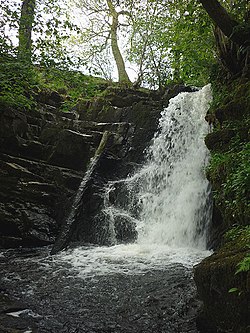
Beetham is situated on the border with Lancashire, 6 miles (10 km) north of Carnforth. It is part of the Arnside and Silverdale Area of Outstanding Natural Beauty. In the 2001 census the parish had a population of 1,724. When you visit Beetham, Walkfo brings Beetham places to life as you travel by foot, bike, bus or car with a mobile phone & headphones.
Beetham Places Overview: History, Culture & Facts about Beetham
Visit Beetham – Walkfo’s stats for the places to visit
With 29 audio plaques & Beetham places for you to explore in the Beetham area, Walkfo is the world’s largest heritage & history digital plaque provider. The AI continually learns & refines facts about the best Beetham places to visit from travel & tourism authorities (like Wikipedia), converting history into an interactive audio experience.
Beetham history
Up to 1066 Earl Tostig was lord of Beetham and the surrounding areas of Cumbria and Lancashire. Beetham manor then amounted to 25 carucates (ca3000 acres/1250ha) of ploughland.
Beetham geography / climate
The River Bela flows past the village and through the deer park of Dallam Tower. To the north of the village is the Billerud paper factory employing 140 people and producing 45,000 tonnes/year. Beetham Hall is a 14th-century fortified manor house, now largely ruined.
Why visit Beetham with Walkfo Travel Guide App?
 You can visit Beetham places with Walkfo Beetham to hear history at Beetham’s places whilst walking around using the free digital tour app. Walkfo Beetham has 29 places to visit in our interactive Beetham map, with amazing history, culture & travel facts you can explore the same way you would at a museum or art gallery with information audio headset. With Walkfo, you can travel by foot, bike or bus throughout Beetham, being in the moment, without digital distraction or limits to a specific walking route. Our historic audio walks, National Trust interactive audio experiences, digital tour guides for English Heritage locations are available at Beetham places, with a AI tour guide to help you get the best from a visit to Beetham & the surrounding areas.
“Curated content for millions of locations across the UK, with 29 audio facts unique to Beetham places in an interactive Beetham map you can explore.”
Walkfo: Visit Beetham Places Map
29 tourist, history, culture & geography spots
Beetham historic spots | Beetham tourist destinations | Beetham plaques | Beetham geographic features |
| Walkfo Beetham tourism map key: places to see & visit like National Trust sites, Blue Plaques, English Heritage locations & top tourist destinations in Beetham | |||
Best Beetham places to visit
Beetham has places to explore by foot, bike or bus. Below are a selection of the varied Beetham’s destinations you can visit with additional content available at the Walkfo Beetham’s information audio spots:
 | Peasey Beck Peasey Beck is a 19.6-kilometre-long (12.2 mi) beck flowing through Cumbria. It rises on Lambrigg Fell, flows through Killington Reservoir and converges with Stainton Beck to form the River Bela. |
 | St Thomas’ Church, Milnthorpe St Thomas’ Church is in the village of Milnthorpe, Cumbria, England. It is an active Anglican parish church in the deanery of Kendal and the archdeaconry of Westmorland and Furness. |
 | Dallam Tower Dallam Tower is a grade I listed country house in Beetham parish, near Milnthorpe, South Lakeland, Cumbria. The house is described as “Early C18 with C17 core, remodelled early C19” and has rainwater pipes dated 1722. It has a deer park of 190 acres (75 ha) with a prominent grade II listed 18th-century deer shelter. The shelter was damaged by fire in April 2021. |
 | Heversham railway station Heversham railway station was on the Hincaster branch line. It was located near Carnforth, with trains to Kendal and Grange over Sands. |
 | Trowbarrow Quarry Trowbarrow Quarry is a disused limestone quarry near Silverdale, Lancashire. It is a geological Site of Special Scientific Interest and a Local Nature Reserve. |
 | St James’ Church, Arnside St James’ Church is in Arnside, Cumbria, England. It is an active Anglican parish church in the deanery of Kendal, the archdeaconry of Westmorland and Furness, and the diocese of Carlisle. |
Visit Beetham plaques
 21
21
plaques
here Beetham has 21 physical plaques in tourist plaque schemes for you to explore via Walkfo Beetham plaques audio map when visiting. Plaques like National Heritage’s “Blue Plaques” provide visual geo-markers to highlight points-of-interest at the places where they happened – and Walkfo’s AI has researched additional, deeper content when you visit Beetham using the app. Experience the history of a location when Walkfo local tourist guide app triggers audio close to each Beetham plaque. Explore Plaques & History has a complete list of Hartlepool’s plaques & Hartlepool history plaque map.


 Trying to encourage visitors to Beetham?