Welcome to Visit Beckton Places
The Walkfo guide to things to do & explore in Beckton
 Visit Beckton places using Walkfo for free guided tours of the best Beckton places to visit. A unique way to experience Beckton’s places, Walkfo allows you to explore Beckton as you would a museum or art gallery with audio guides.
Visiting Beckton Walkfo Preview
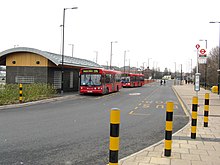
Beckton is within the London Borough of Newham and is 8 miles (12.9 km) east of Charing Cross. Historically part of Essex, Beckton was unpopulated marshland adjacent to the River Thames until the development of major industrial infrastructure in the 19th century. Housing was created in Beckton for workers of the gas and sewage works. When you visit Beckton, Walkfo brings Beckton places to life as you travel by foot, bike, bus or car with a mobile phone & headphones.
Beckton Places Overview: History, Culture & Facts about Beckton
Visit Beckton – Walkfo’s stats for the places to visit
 With 209 audio plaques & Beckton places for you to explore in the Beckton area, Walkfo is the world’s largest heritage & history digital plaque provider. The AI continually learns & refines facts about the best Beckton places to visit from travel & tourism authorities (like Wikipedia), converting history into an interactive audio experience.
Beckton history
Toponymy
Beckton is named after Simon Adams Beck, the governor of the Gas Light and Coke Company when work building Beckton Gas Works began in November 1868.
Beckton sewage works
Beckton Sewage treatment works were first established in 1864 as part of Joseph Bazalgette’s scheme to remove sewage (and hence reduce disease) from London by creating two large sewers from the capital. The site was mooted in 2005 as the location for a desalination plant, but the proposal was rejected by Mayor Ken Livingstone as environmentally unacceptable.
Beckton gasworks
Beckton Gas Works, the largest gasworks in Europe, closed in 1976. An extensive toxic spoil-heap from the Gasworks was known ironically as ‘Beckton Alps’ Originally running from the Northern outfall sewer south to Winsor Terrace, this was landscaped in the 1980s.
Urban development

Beckton has been redeveloped as part of the Docklands project. It now comprises mainly housing and several out-of-town shopping centres. Small areas of Victorian housing survive in Winsor Terrace, originally built as accommodation for Gas Light and Coke Company staff.
Beckton geography / climate
Beckton is at the western end of the London Riverside redevelopment zone of the Thames Gateway. The area around Prince Regent Lane is also known as Custom House. The Gallions Reach Crossing will connect Beckton to Thamesmead on the southern bank of the River Thames.
Why visit Beckton with Walkfo Travel Guide App?
 You can visit Beckton places with Walkfo Beckton to hear history at Beckton’s places whilst walking around using the free digital tour app. Walkfo Beckton has 209 places to visit in our interactive Beckton map, with amazing history, culture & travel facts you can explore the same way you would at a museum or art gallery with information audio headset. With Walkfo, you can travel by foot, bike or bus throughout Beckton, being in the moment, without digital distraction or limits to a specific walking route. Our historic audio walks, National Trust interactive audio experiences, digital tour guides for English Heritage locations are available at Beckton places, with a AI tour guide to help you get the best from a visit to Beckton & the surrounding areas.
“Curated content for millions of locations across the UK, with 209 audio facts unique to Beckton places in an interactive Beckton map you can explore.”
Walkfo: Visit Beckton Places Map
209 tourist, history, culture & geography spots
Beckton historic spots | Beckton tourist destinations | Beckton plaques | Beckton geographic features |
| Walkfo Beckton tourism map key: places to see & visit like National Trust sites, Blue Plaques, English Heritage locations & top tourist destinations in Beckton | |||
Best Beckton places to visit
Beckton has places to explore by foot, bike or bus. Below are a selection of the varied Beckton’s destinations you can visit with additional content available at the Walkfo Beckton’s information audio spots:
 | Gilbert’s Pit Gilbert’s Pit is a geological Site of Special Scientific Interest in Charlton . It was notified in 1985 and was formerly known as Charlton Sand Pit . It adjoins Maryon Park and is close to Maryon Wilson Park . |
| North Woolwich North Woolwich is located on the northern bank of the River Thames, across the river from Woolwich. It is connected to Woolwich by the Woolwich Ferry and Woolwich foot tunnel. Despite lying on the north, Essex side of the Thames, the area is within the historic county of Kent. It was part of the parish of Woolwich in the Blackheath hundred. |
 | Charlton cemetery Charlton cemetery is a cemetery, opened in 1855, covering 15 acres of ground in Charlton, south-east London . Situated in Cemetery Lane to the east of Charlton Park, features two 19th-century chapels and numerous military graves . |
 | Old Woolwich Old Woolwich or Woolwich Central Riverside is an area along the Thames in Woolwich, South East London . It is the oldest inhabited part of Woolwich going back to an Anglo-Saxon riverside settlement . Most of the area was cleared in the 20th and early 21st centuries to make way for large-scale developments . |
 | Bathway Quarter Most buildings in the Bathway Quarter are Grade II* Grade II or locally listed . The area as a whole is designated a conservation area by Greenwich Council . Several were designed by local architect Henry Hudson Church . |
| HyMag HYMAG (formerly the Hyman Archive) is a British archive of popular publications based in London . HYMAG was formerly known as HYMAG . |
| Beckton Beckton is within the London Borough of Newham and is 8 miles (12.9 km) east of Charing Cross. Historically part of Essex, Beckton was unpopulated marshland adjacent to the River Thames until the development of major industrial infrastructure in the 19th century. Housing was created in Beckton for workers of the gas and sewage works. |
| Upton Park, London Upton Park is an area of the East London borough of Newham, centred on Green Street which is the boundary between West Ham and East Ham. West Ham United Football Club formerly played at the Boleyn Ground, commonly known as Upton Park. |
Visit Beckton plaques
 12
12
plaques
here Beckton has 12 physical plaques in tourist plaque schemes for you to explore via Walkfo Beckton plaques audio map when visiting. Plaques like National Heritage’s “Blue Plaques” provide visual geo-markers to highlight points-of-interest at the places where they happened – and Walkfo’s AI has researched additional, deeper content when you visit Beckton using the app. Experience the history of a location when Walkfo local tourist guide app triggers audio close to each Beckton plaque. Explore Plaques & History has a complete list of Hartlepool’s plaques & Hartlepool history plaque map.


 Trying to encourage visitors to Beckton?