Travel to Wrexham Map
Wrexham tourist guide map of landmarks & destinations by Walkfo
 Explore
66
travel
spots
 When travelling to Wrexham, Walkfo’s has created a travel guide & Wrexham overview of Wrexham’s hotels & accommodation, Wrexham’s weather through the seasons & travel destinations / landmarks in Wrexham. Experience a unique Wrexham when you travel with Walkfo as your tour guide to Wrexham map.
Wrexham history
Early history
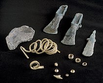
Human activity in the Wrexham area dates back to the Mesolithic period (8000 to 4300 BC), with tools made from flint being found to the east of the town . Two Bronze Age burial mounds are located to the west of the modern town centre . At the time of the Roman conquest of Britain, the area was held by a tribe called the Cornovii .
Medieval

The Battle of Chester circa 615/616 marked the beginning of a long struggle between the Welsh and English for territory in this part of Wales . During the 8th century, the Anglo-Saxon royal house of Mercia pushed their frontiers westwards . The name probably comes from the old English for Wryhtel’s river meadow .
Early Modern
Wrexham became part of the new shire of Denbighshire in 1536 . The main body of the church of St Giles was rebuilt in the late 15th and early 16th centuries . The economic character remained predominantly as an agricultural market town into the 17th century . During the English Civil War, most of the local Welsh gentry supported King Charles I .
Late Modern

Wrexham was known for its leather industry and by the 18th century there were a number of skinners and tanners in the town. The Industrial Revolution began in Wrexham in 1762 when the entrepreneur John Wilkinson (1728–1808), known as “Iron Mad Wilkinson”, opened Bersham Ironworks. Wilkinson’s steam engines enabled a peak of production at Minera Lead Mines on the outskirts of Wrexham. From the late 18th century numerous large-scale industrialised collieries operated in the southern section of the North East Wales coalfield, alongside hundreds of more traditional small-scale pits belonging to a mining tradition dating back to the Middle Ages. 18th century literary visitors included Samuel Johnson, who described Wrexham as “a busy, extensive and well-built town”, and Daniel Defoe who noted the role of Wrexham as a “great market for Welch flannel”. The artist J. M. W. Turner also visited the town in 1792-93 and 1794 which resulted in his drawings of St Giles Parish Church and surrounding buildings and a watercolour painting of a street scene. Rev. William Bingley described Wrexham in 1839 as “of such size and consequence as to have occasionally obtained the appellation of the metropolis of North Wales”. Wrexham gained its first newspaper in 1848. The Market Hall was built in 1848, and in 1863 a volunteer fire brigade was founded. In addition to brewing, tanning became one of Wrexham’s main industries. In the mid 19th century Wrexham was granted borough status. By 1851, the population of Wrexham was 6,714; within thirty years this had increased to 10,978 as the town became increasingly industrialised. Wrexham benefited from good underground water supplies which were essential to the brewing of beer: by the mid-19th century, there were 19 breweries in and around the town. Wrexham Lager brewery was established in 1882 in Central Road and became the first brewery in the United Kingdom to produce lager beer. A permanent military presence was established in the town with the completion of Hightown Barracks in 1877. The Poyser Street drill hall was completed in 1902. When the 1912 National Eisteddfod of Wales was held at Wrexham, T.H. Parry-Williams achieved for the first time the feat, almost unheard of since, of winning both the Chair and the Crown. Parry-Williams later recalled returning home to Rhyd-ddu, where had been working as a hired hand upon the farm of a relative. Upon telling his employer of his double-victory, Parry-Williams was advised to, “seek grace.” When Parry-Williams then explained that both victories had gained him £40, the relative shouted in angry disbelief, “Ac mi gwnest nhw i gyd ar dy din!!!” (“And you earned them all sitting on your arse!!!!”) By 1913, the North East Wales coal field was producing up to 3 million tonnes a year and employed over 10,000 people, dominating the economic and cultural life of the area. One of the worst mining disasters in British history occurred at Gresford Colliery in 1934 when underground explosions and a subsequent fire cost the lives of 266 men. However the industry went into decline after the First World War, and of the seven large-scale collieries operating in the Wrexham area in 1946, only two functional collieries remained by 1968. The last pit to close in the Borough was Bersham Colliery in 1986.The leatherworks in Pentrefelin and Tuttle Street, the many coal mines in the area, the brickworks in Abenbury, Brymbo Steelworks and the breweries all closed in the latter half of the 20th century. Wrexham suffered from the same problems as much of industrialised Britain and saw little investment in the 1970s. In the 1980s and 1990s, the Welsh Development Agency (WDA) funded a major dual carriageway (the A483) bypassing Wrexham town centre and connecting it with nearby Chester and with England’s trunk road network. New shopping areas have been created within the town at Henblas Square, Island Green and Eagles Meadow and the Wrexham Industrial Estate, previously used in the Second World War, has become home to many manufacturing businesses. Wrexham Town Hall, an early 18th century arcaded structure with an assembly hall on the first floor, which had been built at the top of Town Hall, was demolished to improve traffic flows in the area in February 1940. Wrexham’s former police station on Regent Street, originally the barracks for the Royal Denbighshire Militia, is now home to Wrexham County Borough Museum. The museum has two galleries devoted to the history of the town and its surrounding communities. The museum also holds the archive of the Royal Welch Fusiliers; battalions were stationed in Wrexham during the First World War. The collection is notable for containing original documents in the handwriting of Siegfried Sassoon, Robert Graves, J. C. Dunn and other notable members of the RWF, as well as official records.
Wrexham map & travel guide with history & landmarks to explore
Visit Wrexham Walkfo Stats
With 66 travel places to explore on our Wrexham travel map, Walkfo is a personalised tour guide to tell you about the places in Wrexham as you travel by foot, bike, car or bus. No need for a physical travel guide book or distractions by phone screens, as our geo-cached travel content is automatically triggered on our Wrexham map when you get close to a travel location (or for more detailed Wrexham history from Walkfo).
| Travel Location: Travel Area: | Wrexham [zonearea] | Audio spots: Physical plaques: | 66 0 | Population: | [zonesize] |
|---|
Average seasonal temperatures at zone
Tourist Guide to Wrexham Map
Wrexham map historic spot | Wrexham map tourist destination | Wrexham map plaque | Wrexham map geographic feature |
| Walkfo Wrexham travel map key: visit National Trust sites, Blue Plaques, English Heritage locations & top travel destinations in Wrexham | |||