Travel to Winchester Map
Winchester tourist guide map of landmarks & destinations by Walkfo
 Explore
82
travel
spots
 When travelling to Winchester, Walkfo’s has created a travel guide & Winchester overview of Winchester’s hotels & accommodation, Winchester’s weather through the seasons & travel destinations / landmarks in Winchester. Experience a unique Winchester when you travel with Walkfo as your tour guide to Winchester map.
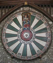
Winchester history
Prehistory
The area around Winchester has been inhabited since prehistoric times. Three Iron Age hillforts, Oram’s Arbour, St. Catherine’s Hill, and Worthy Down all nearby. In the Late Iron Age, a more urban settlement type developed, known as an oppidum.
Roman period
After the Roman conquest of Britain, the settlement served as the capital (Latin: civitas) of the Belgae. At the beginning of the third century, Winchester was given protective stone walls. At around this time the city covered an area of 144 acres (58 ha) Winchester began to decline in the later fourth century.
Medieval period
Winchester appears in early Welsh literature and is commonly identified as the city of Cair Guinntguic listed among the 28 cities of Britain in the History of the Britons. The city may have functioned as a centre for a religious community or a royal palace. In 648 King Cenwalh of Wessex erected the Church of St Peter and St Paul, later known as the Old Minster. The present form of the city dates from reconstruction in the late 9th century.
Modern period

The City Cross (also known as the Buttercross) features 12 statues of the Virgin Mary, other saints and various historical figures. The city walls were originally built in the Roman period covering an area of around 138 acres (56 ha), and were rebuilt and expanded in sections over time. A large portion of the city walls, built on Roman foundations, were demolished in the 18th and 19th centuries.
Winchester map & travel guide with history & landmarks to explore
Visit Winchester Walkfo Stats
With 82 travel places to explore on our Winchester travel map, Walkfo is a personalised tour guide to tell you about the places in Winchester as you travel by foot, bike, car or bus. No need for a physical travel guide book or distractions by phone screens, as our geo-cached travel content is automatically triggered on our Winchester map when you get close to a travel location (or for more detailed Winchester history from Walkfo).
| Travel Location: Travel Area: | Winchester [zonearea] | Audio spots: Physical plaques: | 82 20 | Population: | [zonesize] |
|---|
Average seasonal temperatures at zone
Tourist Guide to Winchester Map
Winchester map historic spot | Winchester map tourist destination | Winchester map plaque | Winchester map geographic feature |
| Walkfo Winchester travel map key: visit National Trust sites, Blue Plaques, English Heritage locations & top travel destinations in Winchester | |||