Travel to Wembley Map
Wembley tourist guide map of landmarks & destinations by Walkfo
 Explore
144
travel
spots
 When travelling to Wembley, Walkfo’s has created a travel guide & Wembley overview of Wembley’s hotels & accommodation, Wembley’s weather through the seasons & travel destinations / landmarks in Wembley. Experience a unique Wembley when you travel with Walkfo as your tour guide to Wembley map.
Wembley history
Toponomy
Wembley is derived from Old English proper name “Wemba” and the Old English “lea” for meadow or clearing. The name was first mentioned in the charter of 825 of Selvin.
The old manor
The village of Wembley grew up on the hill by the clearing with the Harrow Road south of it. In 1547 there were but six houses in Wembley, one of the wealthiest parts of Harrow. At the dissolution of the monasteries in 1543, the manor of Wembley fell to Richard Andrews and Leonard Chamberlain. There was a mill on Wembley Hill by 1673.
Railways, parish formed and development
In 1837, the London & Birmingham Railway (now part of the West Coast Main Line) was opened from London Euston through Wembley to Hemel Hempstead, and completed to Birmingham Curzon Street the following year. The changing names of the local station demonstrated the increasing importance of the ‘Wembley’ name. Since 1917, there have been six platforms at what is now Wembley Central station. The church of Saint John the Evangelist, Wembley was consecrated in 1846, in which year Wembley became a parish.
Empire Exhibition and the Stadium
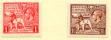
What had been Wembley Park hosted the British Empire Exhibition of 1924–1925. Most of the rest of Wembley’s housing consists of inter-war semi-detached houses and terraces.
Post-war

During the 1960s, rebuilding of Wembley Central station, a block of flats, an open-plan shopping plaza, and a car park were constructed on a concrete raft over the railway. The retail centre of Wembley (the High Road and north end of Ealing Road) has suffered from chronic traffic congestion and from the opening of neighbouring purpose-built shopping centres.
Recent regenerations

The town’s regeneration is one of the major development projects in London in the early 21st century. A shopping plaza along High Road suffered slow decline by the 1980s and was poorly maintained. In a bid to reverse Wembley’s fortunes, in the mid-2000s plans were created and approved to completely regenerate the place, carried out by construction company St. Modwen.
Wembley map & travel guide with history & landmarks to explore
Visit Wembley Walkfo Stats
With 144 travel places to explore on our Wembley travel map, Walkfo is a personalised tour guide to tell you about the places in Wembley as you travel by foot, bike, car or bus. No need for a physical travel guide book or distractions by phone screens, as our geo-cached travel content is automatically triggered on our Wembley map when you get close to a travel location (or for more detailed Wembley history from Walkfo).
| Travel Location: Travel Area: | Wembley [zonearea] | Audio spots: Physical plaques: | 144 21 | Population: | [zonesize] |
|---|
Average seasonal temperatures at zone
Tourist Guide to Wembley Map
Wembley map historic spot | Wembley map tourist destination | Wembley map plaque | Wembley map geographic feature |
| Walkfo Wembley travel map key: visit National Trust sites, Blue Plaques, English Heritage locations & top travel destinations in Wembley | |||