Travel to Sheffield Map
Sheffield tourist guide map of landmarks & destinations by Walkfo
 Explore
290
travel
spots
 When travelling to Sheffield, Walkfo’s has created a travel guide & Sheffield overview of Sheffield’s hotels & accommodation, Sheffield’s weather through the seasons & travel destinations / landmarks in Sheffield. Experience a unique Sheffield when you travel with Walkfo as your tour guide to Sheffield map.
Sheffield history
Early history
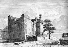
The earliest evidence of human occupation in the Sheffield area was found at Creswell Crags to the east of the city . In the Iron Age the area became the southernmost territory of the Pennine tribe called the Brigantes . The settlements that grew and merged to form Sheffield are of Anglo-Saxon and Danish origin .
Industrial Revolution

During the 1740s, a form of the crucible steel process was discovered that allowed the manufacture of a better quality of steel than had previously been possible . In about the same period, a technique was developed for fusing a thin sheet of silver onto a copper ingot to produce silver plating, which became widely known as Sheffield plate . The resulting poor conditions culminated in a cholera epidemic that killed 402 people in 1832 . The population of the town grew rapidly throughout the 19th century; increasing from 60,095 in 1801 to 451,195 by 1901 .
Blitz
Sheffield’s steel factories were set to work manufacturing weapons and ammunition for the war effort . As a result, the city became a target for bombing raids on the nights of 12 and 15 December 1940, now known as the Sheffield Blitz . More than 660 lives were lost and many buildings were destroyed or damaged .
Post-Second World War
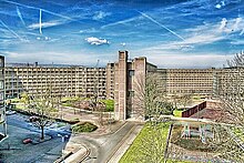
In the 1950s and 1960s, many of the city’s slums were demolished and replaced with housing schemes such as Park Hill flats . The 1980s saw the worst of this run-down of Sheffield’s industries, along with those of many other areas of the UK . Attempts to regenerate the city were kick-started when the city hosted the 1991 World Student Games .
21st century
Sheffield was particularly hard hit during the 2007 United Kingdom floods and the 2010 ‘Big Freeze’ Many landmark buildings such as Meadowhall and the Hillsborough Stadium flooded due to being close to rivers that flow through the city . In 2010, 5,000 properties in Sheffield were identified as still being at risk of flooding . In 2012 the city narrowly escaped another flood, despite extensive work by the Environment Agency to clear local river channels since the 2007 event .
Sheffield map & travel guide with history & landmarks to explore
Visit Sheffield Walkfo Stats
With 290 travel places to explore on our Sheffield travel map, Walkfo is a personalised tour guide to tell you about the places in Sheffield as you travel by foot, bike, car or bus. No need for a physical travel guide book or distractions by phone screens, as our geo-cached travel content is automatically triggered on our Sheffield map when you get close to a travel location (or for more detailed Sheffield history from Walkfo).
| Travel Location: Travel Area: | Sheffield [zonearea] | Audio spots: Physical plaques: | 290 71 | Population: | [zonesize] |
|---|
Average seasonal temperatures at zone
Tourist Guide to Sheffield Map
Sheffield map historic spot | Sheffield map tourist destination | Sheffield map plaque | Sheffield map geographic feature |
| Walkfo Sheffield travel map key: visit National Trust sites, Blue Plaques, English Heritage locations & top travel destinations in Sheffield | |||