Travel to Dollis Hill Map
Dollis Hill tourist guide map of landmarks & destinations by Walkfo
 Explore
222
travel
spots
 When travelling to Dollis Hill, Walkfo’s has created a travel guide & Dollis Hill overview of Dollis Hill’s hotels & accommodation, Dollis Hill’s weather through the seasons & travel destinations / landmarks in Dollis Hill. Experience a unique Dollis Hill when you travel with Walkfo as your tour guide to Dollis Hill map.
Dollis Hill history
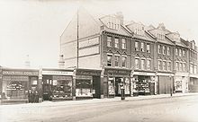
Dollis Hill Estate was formed in the early 19th century, when the Finch family bought up a number of farms in the area to form a single estate. The first railway was the Dudding Hill Line, opened in 1875 by the Midland Railway to connect its Midland Main Line and Cricklewood goods yard in the east to other lines to the southwest. In World War I the tank design team responsible for the new Anglo-American or Liberty tank, Mark VIII was located here.
Dollis Hill map & travel guide with history & landmarks to explore
Visit Dollis Hill Walkfo Stats
With 222 travel places to explore on our Dollis Hill travel map, Walkfo is a personalised tour guide to tell you about the places in Dollis Hill as you travel by foot, bike, car or bus. No need for a physical travel guide book or distractions by phone screens, as our geo-cached travel content is automatically triggered on our Dollis Hill map when you get close to a travel location (or for more detailed Dollis Hill history from Walkfo).
| Travel Location: Travel Area: | Dollis Hill [zonearea] | Audio spots: Physical plaques: | 222 90 | Population: | [zonesize] |
|---|
Average seasonal temperatures at zone
Tourist Guide to Dollis Hill Map
Dollis Hill map historic spot | Dollis Hill map tourist destination | Dollis Hill map plaque | Dollis Hill map geographic feature |
| Walkfo Dollis Hill travel map key: visit National Trust sites, Blue Plaques, English Heritage locations & top travel destinations in Dollis Hill | |||