Travel to Chew Stoke Map
Chew Stoke tourist guide map of landmarks & destinations by Walkfo
 Explore
21
travel
spots
 When travelling to Chew Stoke, Walkfo’s has created a travel guide & Chew Stoke overview of Chew Stoke’s hotels & accommodation, Chew Stoke’s weather through the seasons & travel destinations / landmarks in Chew Stoke. Experience a unique Chew Stoke when you travel with Walkfo as your tour guide to Chew Stoke map.
Chew Stoke history
Prehistory
Archaeological excavations carried out between 1953 and 1955 by Philip Rahtz and Ernest Greenfield from the Ministry of Works found evidence of extensive human occupation of the area. Consecutive habitation spanning thousands of years from the Upper Palaeolithic, Mesolithic, and Neolithic periods (Old, Middle, and New Stone Age), to the Bronze and Iron Ages had left numerous artefacts behind. Discoveries have included stone knives, flint blades, and the head of a mace.
Romano-Celtic temple
Chew Stoke is the site of a Romano-Celtic double-octagonal temple, possibly dedicated to Mercury. The temple was excavated by Philip Rahtz between 1949 and 1951. It consisted of an inner wall, which formed the sanctuary, surrounded by an outer wall forming an ambulatory, or covered walkway 56.5 feet (17.2 m) across.
Middle Ages
In the Domesday Book of 1086, Chew Stoke was listed as Chiwestoche, and was recorded as belonging to Gilbert Fitz-Turold. He conspired with the Duke of Normandy against King William Rufus, and subsequently, all his lands were seized. The next recorded owner was Lord Beauchamp of Hache, who became “lord of the manor”
Bilbie family of bell and clockmakers

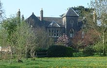
Bilbie family of bell founders and clockmakers lived and worked in Chew Stoke for more than 200 years. They produced more than 1,350 church bells, which were hung in churches all over the West Country. Their oldest surviving bell, cast in 1698, is still giving good service in the local St Andrew’s Church.
Recent history
In the 20th century, Chew Stoke expanded slightly with the influx of residents from the Chew Valley Lake area. In World War II, 42 children and three teachers, who had been evacuated from Avenmore school in London, were accommodated in the village. On 10 July 1968, torrential rainfall, with 175 millimetres (7 in) falling in 18 hours, led to widespread flooding.
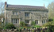
Chew Stoke map & travel guide with history & landmarks to explore
Visit Chew Stoke Walkfo Stats
With 21 travel places to explore on our Chew Stoke travel map, Walkfo is a personalised tour guide to tell you about the places in Chew Stoke as you travel by foot, bike, car or bus. No need for a physical travel guide book or distractions by phone screens, as our geo-cached travel content is automatically triggered on our Chew Stoke map when you get close to a travel location (or for more detailed Chew Stoke history from Walkfo).
| Travel Location: Travel Area: | Chew Stoke [zonearea] | Audio spots: Physical plaques: | 21 0 | Population: | [zonesize] |
|---|
Average seasonal temperatures at zone
Tourist Guide to Chew Stoke Map
Chew Stoke map historic spot | Chew Stoke map tourist destination | Chew Stoke map plaque | Chew Stoke map geographic feature |
| Walkfo Chew Stoke travel map key: visit National Trust sites, Blue Plaques, English Heritage locations & top travel destinations in Chew Stoke | |||