Travel to Chalk, Kent Map
Chalk, Kent tourist guide map of landmarks & destinations by Walkfo
 Explore
42
travel
spots
 When travelling to Chalk, Kent, Walkfo’s has created a travel guide & Chalk, Kent overview of Chalk, Kent’s hotels & accommodation, Chalk, Kent’s weather through the seasons & travel destinations / landmarks in Chalk, Kent. Experience a unique Chalk, Kent when you travel with Walkfo as your tour guide to Chalk, Kent map.
Chalk, Kent history
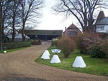
Chalk in the 8th century was known to people as witanagemot (a Saxon meeting) held here, is mentioned in the Domesday Book. An Iron Age settlement was discovered near St. Mary’s Church during the laying of a gas pipeline.
Chalk, Kent map & travel guide with history & landmarks to explore
Visit Chalk, Kent Walkfo Stats
With 42 travel places to explore on our Chalk, Kent travel map, Walkfo is a personalised tour guide to tell you about the places in Chalk, Kent as you travel by foot, bike, car or bus. No need for a physical travel guide book or distractions by phone screens, as our geo-cached travel content is automatically triggered on our Chalk, Kent map when you get close to a travel location (or for more detailed Chalk, Kent history from Walkfo).
| Travel Location: Travel Area: | Chalk, Kent [zonearea] | Audio spots: Physical plaques: | 42 0 | Population: | [zonesize] |
|---|
Average seasonal temperatures at zone
Tourist Guide to Chalk, Kent Map
Chalk, Kent map historic spot | Chalk, Kent map tourist destination | Chalk, Kent map plaque | Chalk, Kent map geographic feature |
| Walkfo Chalk, Kent travel map key: visit National Trust sites, Blue Plaques, English Heritage locations & top travel destinations in Chalk, Kent | |||