Travel to Carlisle Map
Carlisle tourist guide map of landmarks & destinations by Walkfo
 Explore
69
travel
spots
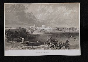
 When travelling to Carlisle, Walkfo’s has created a travel guide & Carlisle overview of Carlisle’s hotels & accommodation, Carlisle’s weather through the seasons & travel destinations / landmarks in Carlisle. Experience a unique Carlisle when you travel with Walkfo as your tour guide to Carlisle map.
Carlisle history
Ancient Carlisle
The earliest recorded inhabitants were the Carvetii tribe of Britons who made up the main population of ancient Cumbria and North Lancashire. The Roman settlement was named Luguvalium, based on a native name that has been reconstructed as Brittonic *Luguwaljon, “[city] of Luguwalos”, a masculine Celtic given name meaning “strength of Lugus”
Middle Ages

Carlisle Castle began in 1093 on the site of the Roman fort, south of the River Eden. The castle was rebuilt in stone in 1112, with a keep and the city walls. Carlisle Cathedral was founded as an Augustinian priory and became a cathedral in 1133. By the time of the Norman conquest in 1066, Carlisle was part of Scotland.
Early Modern era
After the Pilgrimage of Grace, Henry VIII employed Stefan von Haschenperg to modernise the defences of Carlisle. The castle was refortified using stone from the cathedral cloisters in 1639. In 1642 the English Civil War broke out and the castle was garrisoned for the king. In 1707 an act of union was passed between England and Scotland, creating Great Britain.
Industrial Revolution

The post of Governor of Carlisle as garrison commander was abolished in 1838. In the early 19th century textile mills, engineering works and food manufacturers built factories in the city. The expanding industries brought about an increase in population as jobs shifted from rural farms towards the cities.
Modern history

In 1916, the government took over the public houses and breweries in Carlisle because of drunkenness among construction and munitions workers from the munitions factory at Gretna. In 1912, the boundaries of Carlisle were extended to include Botcherby in the east and Stanwix in the north. During the Second World War, Carlisle hosted over 5,000 evacuees, many of whom arrived from Newcastle upon Tyne and surrounding towns. In 2005, the rivers Eden, Caldew and Petteril burst their banks due to as much as 180 mm rainfall up stream.
Carlisle map & travel guide with history & landmarks to explore
Visit Carlisle Walkfo Stats
With 69 travel places to explore on our Carlisle travel map, Walkfo is a personalised tour guide to tell you about the places in Carlisle as you travel by foot, bike, car or bus. No need for a physical travel guide book or distractions by phone screens, as our geo-cached travel content is automatically triggered on our Carlisle map when you get close to a travel location (or for more detailed Carlisle history from Walkfo).
| Travel Location: Travel Area: | Carlisle [zonearea] | Audio spots: Physical plaques: | 69 4 | Population: | [zonesize] |
|---|
Average seasonal temperatures at zone
Tourist Guide to Carlisle Map
Carlisle map historic spot | Carlisle map tourist destination | Carlisle map plaque | Carlisle map geographic feature |
| Walkfo Carlisle travel map key: visit National Trust sites, Blue Plaques, English Heritage locations & top travel destinations in Carlisle | |||