Travel to Cambridge Map
Cambridge tourist guide map of landmarks & destinations by Walkfo
 Explore
270
travel
spots
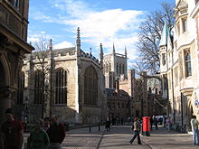
 When travelling to Cambridge, Walkfo’s has created a travel guide & Cambridge overview of Cambridge’s hotels & accommodation, Cambridge’s weather through the seasons & travel destinations / landmarks in Cambridge. Experience a unique Cambridge when you travel with Walkfo as your tour guide to Cambridge map.
Cambridge history
Prehistory
Settlements have existed around the Cambridge area since prehistoric times. The earliest clear evidence of occupation is the remains of a 3,500-year-old farmstead discovered at the site of Fitzwilliam College.
Roman
The principal Roman site is a small fort (castrum) Duroliponte on Castle Hill, just northwest of the city centre. Fort was constructed around AD 70 and converted to civilian use around 50 years later. Evidence of more widespread Roman settlement has been discovered including numerous farmsteads and a village in the Cambridge district of Newnham.
Medieval
Evidence exists that the invading Anglo-Saxons had begun occupying the area by the end of the century. By the 7th century, Cambridge was less significant and described by Bede as a “little ruined city” William of Normandy built a castle on Castle Hill in 1068, two years after his conquest of England. The first town charter was granted by Henry I between 1120 and 1131. Cambridge University was founded by Oxford students fleeing from hostility.
Early modern

Cambridge played a significant role in the early part of the English Civil War. It was the headquarters of the Eastern Counties Association, an organisation administering a regional East Anglian army. The town’s castle was fortified and garrisoned with troops and some bridges were destroyed to aid its defence.
Early-industrial era
Inclosure Acts of 1801 and 1807 enabled the town to expand over surrounding fields. In 1912 and again in 1935 its boundaries were extended to include Chesterton, Cherry Hinton, and Trumpington. The railway came to Cambridge in 1845 after initial resistance, with the opening of the Great Eastern Railway’s London to Norwich line.
20th and 21st centuries
During the Second World War, Cambridge was an important centre for defence of the east coast. During the war Cambridge served as an evacuation centre for over 7,000 people from London, as well as for parts of the University of London. Cambridge was granted its city charter in 1951 in recognition of its history, administrative importance and economic success.
Cambridge map & travel guide with history & landmarks to explore
Visit Cambridge Walkfo Stats
With 270 travel places to explore on our Cambridge travel map, Walkfo is a personalised tour guide to tell you about the places in Cambridge as you travel by foot, bike, car or bus. No need for a physical travel guide book or distractions by phone screens, as our geo-cached travel content is automatically triggered on our Cambridge map when you get close to a travel location (or for more detailed Cambridge history from Walkfo).
| Travel Location: Travel Area: | Cambridge [zonearea] | Audio spots: Physical plaques: | 270 39 | Population: | [zonesize] |
|---|
Average seasonal temperatures at zone
Tourist Guide to Cambridge Map
Cambridge map historic spot | Cambridge map tourist destination | Cambridge map plaque | Cambridge map geographic feature |
| Walkfo Cambridge travel map key: visit National Trust sites, Blue Plaques, English Heritage locations & top travel destinations in Cambridge | |||